Gaza's Huge Reconstruction Challenge: Key Facts and Figures
Palestinians remove the rubble of houses destroyed by Israeli strikes, amid Israel-Hamas conflict, in Khan Younis in the southern Gaza Strip, September 4, 2024. REUTERS/Hatem Khaled/File Photo Purchase Licensing Rights
Gaza's Huge Reconstruction Challenge: Key Facts and Figures
Palestinians remove the rubble of houses destroyed by Israeli strikes, amid Israel-Hamas conflict, in Khan Younis in the southern Gaza Strip, September 4, 2024. REUTERS/Hatem Khaled/File Photo Purchase Licensing Rights
Billions of dollars will be needed to rebuild Gaza when the war between Israel and the Palestinian group Hamas ends, according to assessments from the United Nations.
Here is a breakdown of the destruction in Gaza from the conflict prompted by the Oct. 7 attack on Israel by militants led by the then Hamas rulers of the long-besieged Palestinian enclave, according to Reuters.
HOW MANY CASUALTIES ARE THERE?
The Hamas attack on Israel killed 1,200 people, according to Israeli tallies. Israel's retaliation has killed more than 41,000 Palestinians and injured around 95,000, according to the Gaza health ministry.
HOW LONG WILL IT TAKE TO CLEAR THE RUBBLE?
The United Nations has warned that removing 40 million tonnes of rubble left in the aftermath of Israel's bombardment could take 15 years and cost between $500-600 million.
The debris is believed to be contaminated with asbestos and likely holds human remains. The Palestinian health ministry estimated in May that 10,000 bodies were missing under the rubble.
HOW MANY HOMES HAVE BEEN DESTROYED?
Rebuilding Gaza's shattered homes will take at least until 2040 but could drag on for many decades, according to a UN report released in May.
Palestinian data shows that about 80,000 homes have been destroyed in the conflict.
According to the United Nations, at least 1.9 million people across the Gaza Strip are internally displaced, including some uprooted more than 10 times. The pre-war population was 2.3 million.
WHAT IS THE INFRASTRUCTURE DAMAGE?
The estimated damage to infrastructure totals $18.5 billion, affecting residential buildings, commerce, industry, and essential services such as education, health, and energy, a UN-World Bank report said.
Gaza City has lost nearly all its water production capacity, with 88% of its water wells and 100% of its desalination plants damaged or destroyed, Oxfam said in a recent report.
HOW WILL GAZA FEED ITSELF?
More than half of Gaza's agricultural land, crucial for feeding the war-ravaged territory's hungry population, has been degraded by conflict, satellite images analysed by the United Nations show.
The data reveals a rise in the destruction of orchards, field crops and vegetables in the Palestinian enclave, where hunger is widespread after 11 months of Israeli bombardment.
WHAT ABOUT SCHOOLS, UNIVERSITIES, RELIGIOUS BUILDINGS?
A report from the Gaza Government Media Office in August enumerated the damage to public facilities. The conflict led to the destruction of 200 government facilities, 122 schools and universities, 610 mosques, and three churches.
Amnesty International's Crisis Evidence Lab has highlighted the extent of destruction along Gaza's eastern boundary. As of May 2024, over 90% of the buildings in this area, including more than 3,500 structures, were either destroyed or severely damaged.
Bleak Future for West Bank Pupils as Budget Cuts Bite
Private tutoring makes up some, but not all of the teaching shortfall for the Hajj twins. Jaafar ASHTIYEH / AFP
At an hour when Ahmad and Mohammed should have been in the classroom, the two brothers sat idle at home in the northern West Bank city of Nablus.
The 10-year-old twins are part of a generation abruptly cut adrift by a fiscal crisis that has slashed public schooling from five days a week to three across the Israeli-occupied Palestinian territory.
The Ramallah-based Palestinian Authority's deepening budget shortfall is cutting through every layer of society across the West Bank.
But nowhere are the consequences more stark than in its schools, where reduced salaries for teachers, shortened weeks and mounting uncertainty are reshaping the future of around 630,000 pupils.
Unable to meet its wage bill in full, the Palestinian Authority has cut teachers' pay to 60 percent, with public schools now operating at less than two-thirds capacity.
"Without proper education, there is no university. That means their future could be lost," Ibrahim al-Hajj, father of the twins, told AFP.
The budget shortfall stems in part from Israel's decision to withhold customs tax revenues it collects on the Palestinian Authority's behalf, a measure taken after the war in Gaza erupted in October 2023.
The West Bank's economy has also been hammered by a halt to permits for Palestinians seeking work in Israel and the proliferation of checkpoints and other movement controls.
- 'No foundation' for learning -
"Educational opportunities we had were much better than what this generation has today," said Aisha Khatib, 57, headmistress of the brothers' school in Nablus.
"Salaries are cut, working days are reduced, and students are not receiving enough education to become properly educated adults," she said, adding that many teachers had left for other work, while some students had begun working to help support their families during prolonged school closures.
Hajj said he worried about the time his sons were losing.
When classes are cancelled, he and his wife must leave the boys alone at home, where they spend much of the day on their phones or watching television.
Part of the time, the brothers attend private tutoring.
"We go downstairs to the teacher and she teaches us. Then we go back home," said Mohammad, who enjoys English lessons and hopes to become a carpenter.
But the extra lessons are costly, and Hajj, a farmer, said he cannot indefinitely compensate for what he sees as a steady academic decline.
Tamara Shtayyeh, a teacher in Nablus, said she had seen the impact firsthand in her own household.
Her 16-year-old daughter Zeena, who is due to sit the Palestinian high school exam, Tawjihi, next year, has seen her average grades drop by six percentage points since classroom hours were reduced, Shtayyeh said.
Younger pupils, however, may face the gravest consequences.
"In the basic stage, there is no proper foundation," she said. "Especially from first to fourth grade, there is no solid grounding in writing or reading."
Irregular attendance, with pupils out of school more often than in, has eroded attention spans and discipline, she added.
"There is a clear decline in students' levels -- lower grades, tension, laziness," Shtayyeh said.
- 'Systemic emergency' -
For UN-run schools teaching around 48,000 students in refugee camps across the West Bank, the picture is equally bleak.
The territory has shifted from "a learning poverty crisis to a full-scale systemic emergency," said Jonathan Fowler, spokesman for the UN agency for Palestinian refugees, UNRWA.
UNRWA schools are widely regarded as offering comparatively high educational standards.
But Fowler said proficiency in Arabic and mathematics had plummeted in recent years, driven not only by the budget crisis but also by Israeli military incursions and the lingering effects of the Covid-19 pandemic.
"The combination of hybrid schooling, trauma and over 2,000 documented incidents of military or settler interference in 2024-25 has resulted in a landscape of lost learning for thousands of Palestinian refugee students," he said.
UNRWA itself is weighing a shorter school week as it grapples with its own funding shortfall, after key donor countries - including the United States under President Donald Trump - halted contributions to the agency, the main provider of health and education services in West Bank refugee camps.
In the northern West Bank, where Israeli military operations in refugee camps displaced around 35,000 people in 2025, some pupils have lost up to 45 percent of learning days, Fowler said.
Elsewhere, schools face demolition orders from Israeli authorities or outright closure, including six UNRWA schools in annexed east Jerusalem.
Teachers say the cumulative toll is profound.
"We are supposed to look toward a bright and successful future," Shtayyeh said. "But what we are seeing is things getting worse and worse."
Security Issues Complicate Tasks of ‘Technocratic Committee’ in Gaza Striphttps://english.aawsat.com/features/5240786-security-issues-complicate-tasks-%E2%80%98technocratic-committee%E2%80%99-gaza-strip
Security Issues Complicate Tasks of ‘Technocratic Committee’ in Gaza Strip
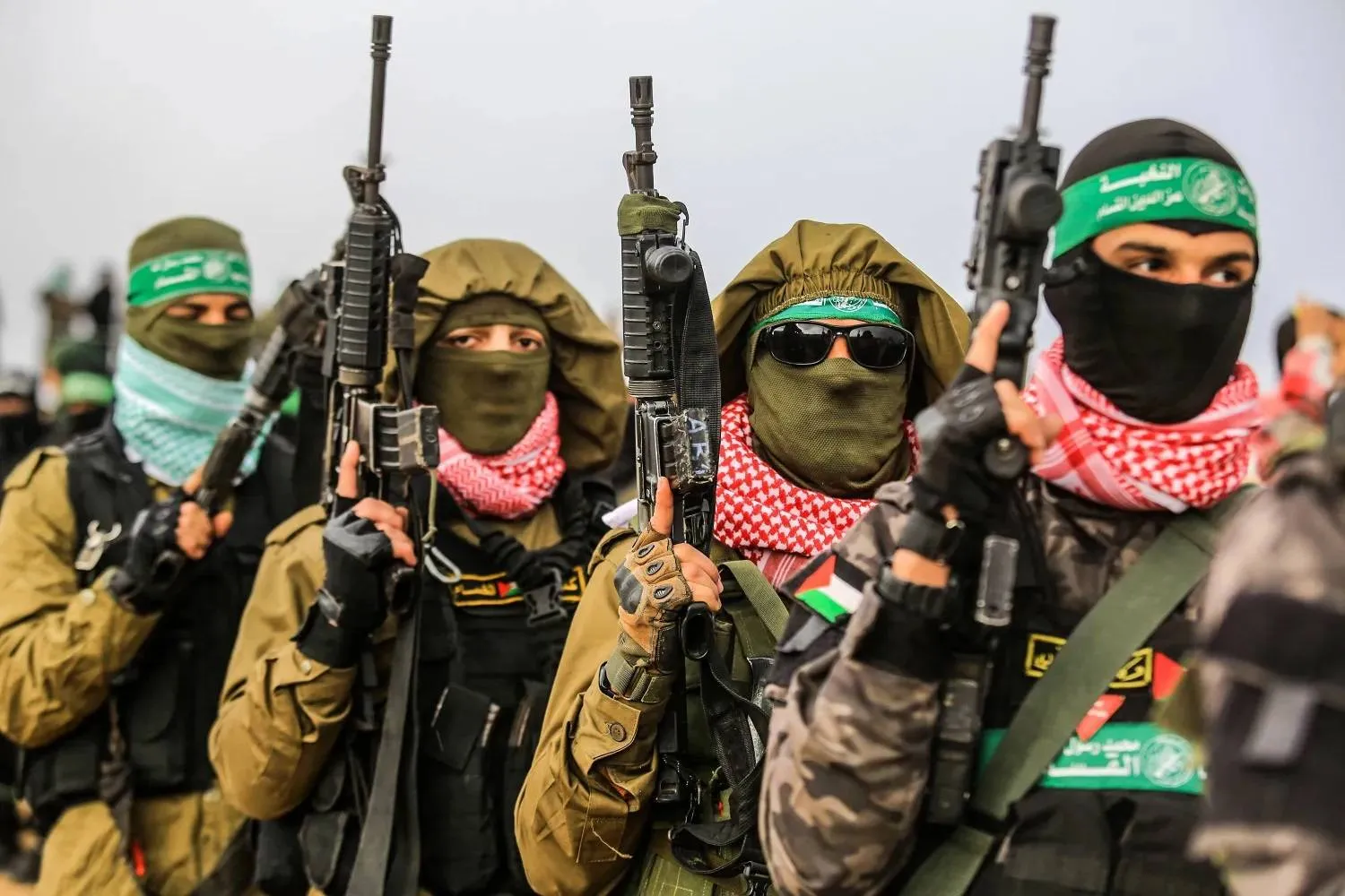
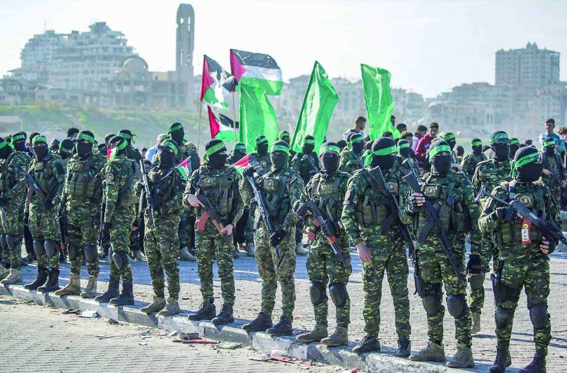
Fighters from the Izz ad-Din al-Qassam Brigades, the armed wing of Hamas, in Khan Younis, Gaza Strip, Feb. 20, 2025. (dpa)
The Palestinian National Committee tasked with administering the Gaza Strip is facing a number of challenges that go beyond Israel’s continued veto on its entry into the enclave via the Rafah crossing. These challenges extend to several issues related to the handover of authority from Hamas, foremost among them the security file.
Nasman and the Interior Ministry File
During talks held to form the committee, and even after its members were selected, Hamas repeatedly sought to exclude retired Palestinian intelligence officer Sami Nasman from the interior portfolio, which would be responsible for security conditions inside the Gaza Strip. Those efforts failed amid insistence by mediators and the United States that Nasman remain in his post, after Rami Hilles, who had been assigned the religious endowments and religious affairs portfolio, was removed in response to Hamas’s demands, as well as those of other Palestinian factions.
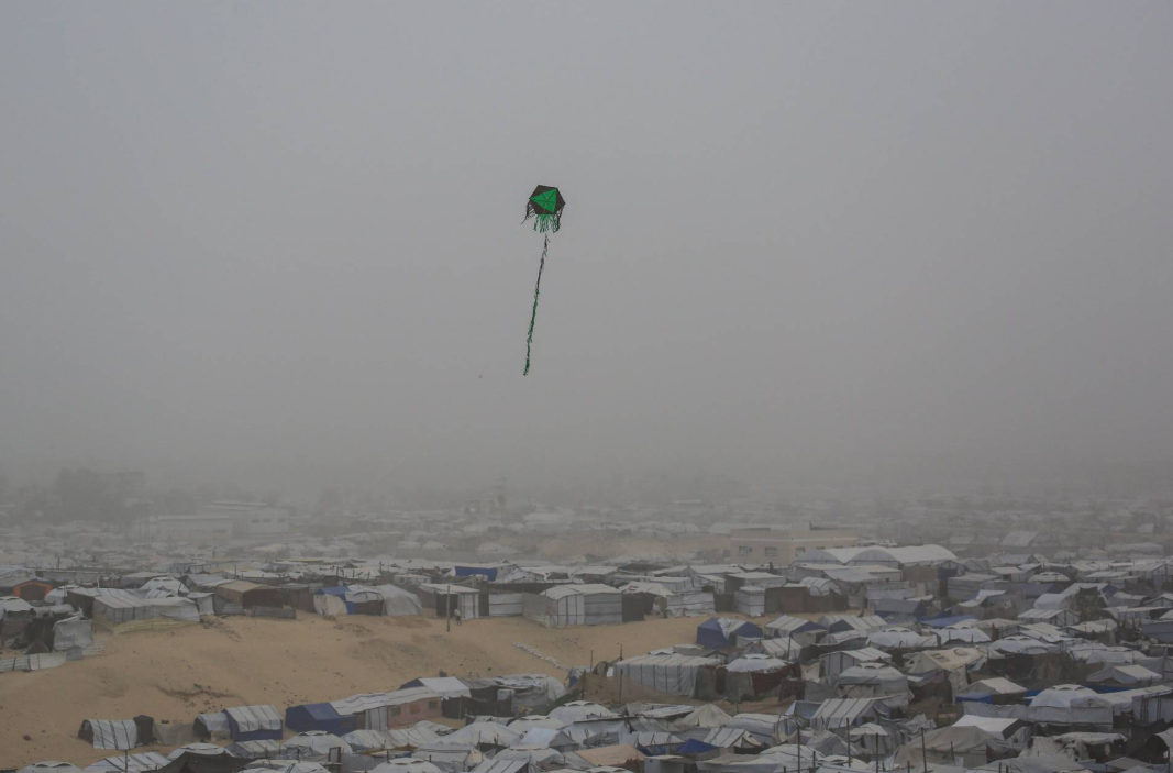
A kite flies over a camp for displaced people in Khan Younis, in the Gaza Strip, on Saturday. (AFP)
Sources close to the committee told Asharq Al-Awsat that Hamas continues to insist that its security personnel remain in service within the agencies that will operate under the committee’s supervision. This position is rejected not only by the committee’s leadership, but also by the executive body of the Peace Council, as well as other parties including the United States and Israel.
The sources said this issue further complicates the committee’s ability to assume its duties in an orderly manner, explaining that Hamas, by insisting on certain demands related to its security employees and police forces, seeks to impose its presence in one way or another within the committee’s work.
The sources added that there is a prevailing sense within the committee and among other parties that Hamas is determined, by all means, to keep its members within the new administrative framework overseeing the Gaza Strip. They noted that Hamas has continued to make new appointments within the leadership ranks of its security services, describing this as part of attempts to undermine plans prepared by Sami Nasman for managing security.
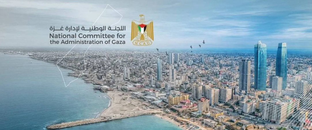
The new logo of the National Committee for the Administration of Gaza, published on its page on X.
Hamas Denies the Allegations
Sources within Hamas denied those accusations. They told Asharq Al-Awsat that Sami Nasman, “as we understand from multiple parties, does not plan to come to Gaza at this time, which raises serious questions about his commitment to managing the Interior portfolio. Without his presence inside the enclave, he cannot exercise his authority, and that would amount to failure.”
The sources said the movement had many reservations about Nasman, who had previously been convicted by Hamas-run courts over what it described as “sabotage” plots. However, given the current reality, Hamas has no objection to his assumption of those responsibilities.
The sources said government institutions in Gaza are ready to hand over authority, noting that each ministry has detailed procedures and a complete framework in place to ensure a smooth transfer without obstacles. They stressed that Hamas is keen on ensuring the success of the National Committee for the Administration of Gaza.
The sources did not rule out the possibility that overarching policies could be imposed on the committee, which would affect its work and responsibilities inside the Gaza Strip, reducing it to merely an instrument for implementing those policies.
Hamas has repeatedly welcomed the committee’s work in public statements, saying it will fully facilitate its mission.
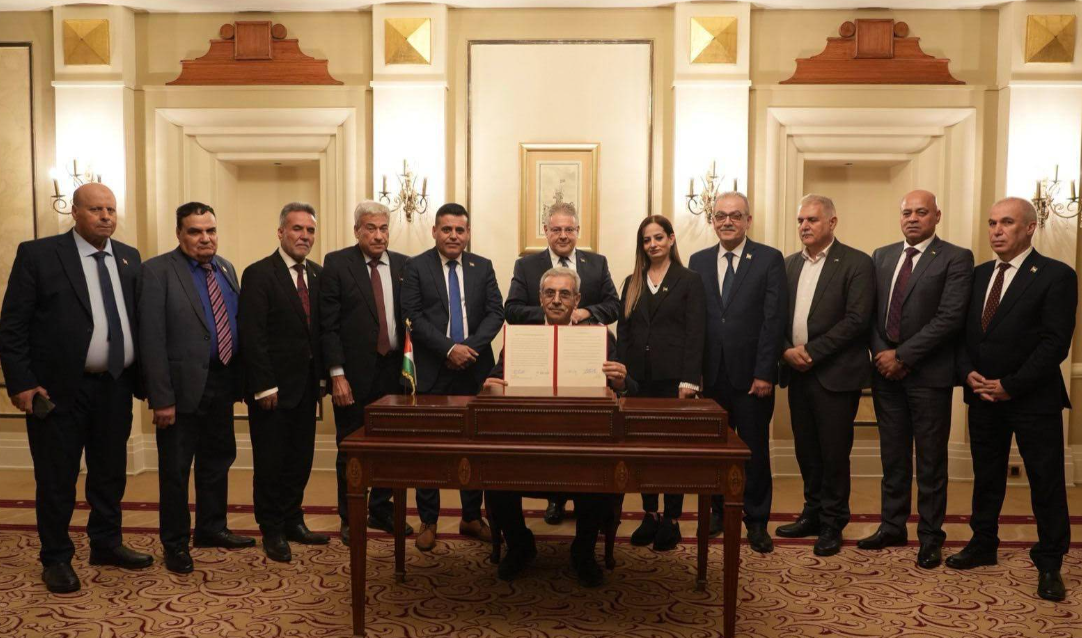
A meeting of the Gaza Administration Committee in Cairo. (File Photo – Egyptian State Information Service)
The Committee’s Position
In a statement issued on Saturday, the National Committee for the Administration of Gaza said that statements and declarations from inside the enclave regarding readiness to transfer the management of all institutions and public facilities represent a step in the interest of citizens and pave the way for the committee to fully assume its responsibilities during the transitional phase.
The committee said that the announcement of readiness for an orderly transition constitutes a pivotal moment for the start of its work as the interim administration of the Gaza Strip, and a real opportunity to halt the humanitarian deterioration and preserve the resilience of residents who have endured severe suffering over the past period, according to the text of the statement.
“Our current priority is to ensure the unimpeded flow of aid, launch the reconstruction process, and create the conditions necessary to strengthen the unity of our people,” the committee said. “This path must be based on clear and defined understandings characterized by transparency and implementability, and aligned with the 20-point plan and UN Security Council Resolution 2803.”
Fighters from Hamas ahead of a prisoner exchange, Feb. 1, 2025. (EPA)
The committee stressed that it cannot effectively assume its responsibilities unless it is granted full administrative and civilian authority necessary to carry out its duties, in addition to policing responsibilities.
“Responsibility requires genuine empowerment that enables it to operate efficiently and independently. This would open the door to serious international support for reconstruction efforts, pave the way for a full Israeli withdrawal, and help restore daily life to normal,” it said.
The committee affirmed its commitment to carrying out this task with a sense of responsibility and professional discipline, and with the highest standards of transparency and accountability, calling on mediators and all relevant parties to expedite the resolution of outstanding issues without delay.
Armed Men in Hospitals
In a related development, the Hamas-run Ministry of Interior and National Security said in a statement on Saturday that it is making continuous and intensive efforts to ensure there are no armed presences within hospitals, particularly involving members of certain families who enter them. The ministry said this is aimed at preserving the sanctity of medical facilities and protecting them as purely humanitarian zones that must remain free of any tensions or armed displays.
The ministry said it has deployed a dedicated police force for field monitoring and enforcement, and to take legal action against violators. It acknowledged facing on-the-ground challenges, particularly in light of repeated Israeli strikes on its personnel while carrying out their duties, which it said has affected the speed of addressing some cases. It said it will continue to carry out its responsibilities with firmness.
Local Palestinian media reported late Friday that Doctors Without Borders decided to suspend all non-urgent medical procedures at Nasser Hospital in Khan Younis starting Jan. 20, 2026, due to concerns related to the management of the facility and the preservation of its neutrality, as well as security breaches inside the hospital complex.
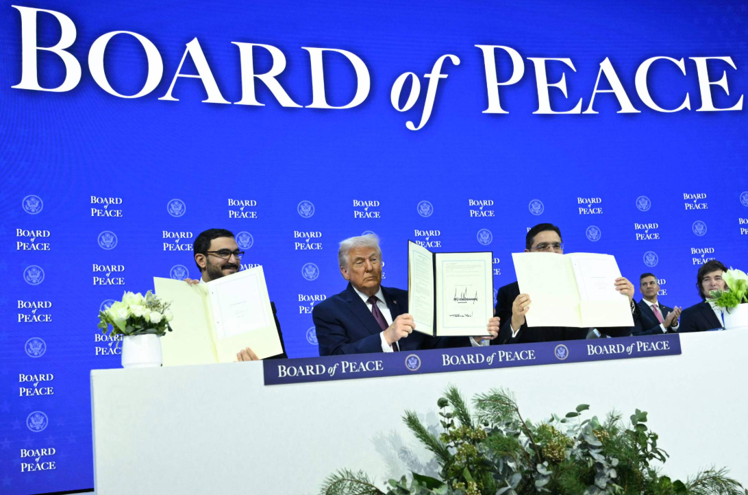
US President Donald Trump holds a document establishing the Peace Council for Gaza in Davos, Switzerland, Jan. 27, 2026. (Reuters)
The organization said in a statement attributed to it, not published on its official platforms or website, that its staff and patients had, in recent months, observed the presence of armed men, some masked, in various areas of the complex, along with incidents of intimidation, arbitrary arrests of patients, and suspected weapons transfers. It said this posed a direct threat to the safety of staff and patients.
Asharq Al-Awsat attempted to obtain confirmation from the organization regarding the authenticity of the statement but received no response.
Field Developments
On the ground, Israeli violations in the Gaza Strip continued. Gunfire from military vehicles and drones, along with artillery shelling, caused injuries in Khan Younis in the south and north of Nuseirat in central Gaza.
Daily demolition operations targeting infrastructure and homes also continued in areas along both sides of the so-called yellow line, across various parts of the enclave.
What is the Two-state Solution to the Israel-Palestinian Conflict?https://english.aawsat.com/features/5240360-what-two-state-solution-israel-palestinian-conflict
FILE PHOTO: Smoke rises following an explosion, within the "yellow line" zone, which is controlled by Israel, in Khan Younis in the southern Gaza Strip, February 10, 2026. Picture taken with a phone. REUTERS/Haseeb Alwazeer/File Photo
What is the Two-state Solution to the Israel-Palestinian Conflict?
FILE PHOTO: Smoke rises following an explosion, within the "yellow line" zone, which is controlled by Israel, in Khan Younis in the southern Gaza Strip, February 10, 2026. Picture taken with a phone. REUTERS/Haseeb Alwazeer/File Photo
Israel has taken steps to help settlers acquire land in the occupied West Bank and widen its powers in parts of the territory where Palestinians have some self-rule - measures they said aimed to undermine the two-state solution.
It marks the latest blow to the idea of establishing a Palestinian state co-existing peacefully alongside Israel in territory Israel captured in the 1967 Middle East war. Long backed by world powers, this vision formed the bedrock of the US-backed peace process ushered in by the 1993 Oslo Accords.
But the obstacles have only grown with time. They include accelerating Jewish settlement on occupied land and uncompromising positions on core issues including borders, the fate of Palestinian refugees and the status of Jerusalem.
WHAT ARE ISRAEL'S NEW DECISIONS?
They would expedite settler land purchases by making public previously confidential West Bank land registries, and also repeal a Jordanian law governing land purchases in the West Bank, which was controlled by Jordan from 1948 until 1967.
Further, Israel would expand "monitoring and enforcement actions" to parts of the West Bank known as areas A and B, specifically "regarding water offences, damage to archaeological sites and environmental hazards that pollute the entire region", a statement by the finance and defense ministers said.
The West Bank was split into Areas A, B and C under the Oslo Accords. The Palestinian Authority has full administrative and security control in Area A - 18% of the territory. In Area B, around 22%, the PA runs civil affairs with security in Israeli hands. Most Palestinians in the West Bank live in areas A and B.
Israel has full control over the remaining 60% - Area C, including the border with Jordan.
Palestinian President Mahmoud Abbas said the measures violate international law and aim to undermine Palestinian institutions and a future two-state solution.
Ultranationalist Israeli Finance Minister Bezalel Smotrich called the decision a "real revolution" and said, "We will continue to kill the idea of a Palestinian state."
WHAT ARE TWO-STATE SOLUTION'S ORIGINS?
Conflict ignited in British-ruled Palestine between Arabs and Jews who had migrated there, seeking a national home as they fled antisemitic persecution in Europe and citing biblical ties to the land throughout centuries in exile.
In 1947, the United Nations agreed on a plan partitioning Palestine into Arab and Jewish states with international rule over Jerusalem. Jewish leaders accepted the plan, which gave them 56% of the land. The Arab League rejected it.
The state of Israel was declared on May 14, 1948. A day later, five Arab states attacked. The war ended with Israel controlling 77% of the territory.
Some 700,000 Palestinians fled or were driven from their homes, ending up in Jordan, Lebanon and Syria as well as in the Gaza Strip, the West Bank and East Jerusalem.
In the 1967 war, Israel captured the West Bank, including East Jerusalem, from Jordan and Gaza from Egypt.
Although 157 of the 193 UN member states already recognize Palestine as a state, it is not itself a UN member, meaning most Palestinians are not recognized by the world body as citizens of any state. About nine million live as refugees in Syria, Lebanon, Jordan and territories captured by Israel in 1967. Another 2 million live in Israel as Israeli citizens.
HAS A DEAL EVER BEEN CLOSE?
The Oslo Accords, signed by Israeli Prime Minister Yizhak Rabin and Palestine Liberation Organization Chairman Yasser Arafat, led the PLO to recognize Israel's right to exist and renounce violence. Palestinians hoped this would be a step towards independence, with East Jerusalem as their capital.
The process suffered multiple reverses on both sides.
Hamas killed more than 330 Israelis in suicide attacks from 1994 to 2005, according to Israel's government. In 2007, the group seized Gaza from the PA in a brief civil war. Hamas' 1988 charter advocates Israel's demise, though in recent years it has said it would accept a Palestinian state along 1967 borders. Israel says that stance is a ruse.
In 1995, Rabin was assassinated by an ultranationalist Jew seeking to derail any land-for-peace deal.
In 2000, US President Bill Clinton brought Arafat and Israeli Prime Minister Ehud Barak to Camp David to clinch a deal, but it failed, with the future of Jerusalem, deemed by Israel as its "eternal and indivisible" capital, the main obstacle.
The conflict escalated with a second Palestinian intifada (uprising) in 2000 to 2005. US administrations sought to revive peacemaking, to no avail, with the last bid collapsing in 2014.
HOW BIG ARE THE OBSTACLES TODAY?
While Israel withdrew settlers and soldiers from Gaza in 2005, settlements expanded in the West Bank and East Jerusalem, their population rising from 250,000 in 1993 to 700,000 three decades later, according to Israeli organization Peace Now. Palestinians say this undermines the basis of a viable state.
Jewish settlement in the West Bank accelerated sharply after the 2023 start of the Gaza war.
During the Second Intifada two decades ago, Israel also constructed a barrier in the West Bank it said was intended to stop Palestinian suicide bombers from entering its cities. Palestinians call the move a land grab.
The PA led by President Mahmoud Abbas administers islands of West Bank land surrounded by a zone of Israeli control comprising 60% of the territory, including the Jordanian border and the settlements, arrangements set out in the Oslo Accords.
Prime Minister Benjamin Netanyahu's government is the most right-wing in Israeli history and includes religious nationalists who draw support from settlers. Smotrich has said there is no such thing as a Palestinian people.
Hamas and Israel have fought repeated wars over the past two decades, culminating in the attacks on communities in southern Israel on October 7, 2023, that ignited the Gaza war.
لم تشترك بعد
انشئ حساباً خاصاً بك لتحصل على أخبار مخصصة لك ولتتمتع بخاصية حفظ المقالات وتتلقى نشراتنا البريدية المتنوعة