

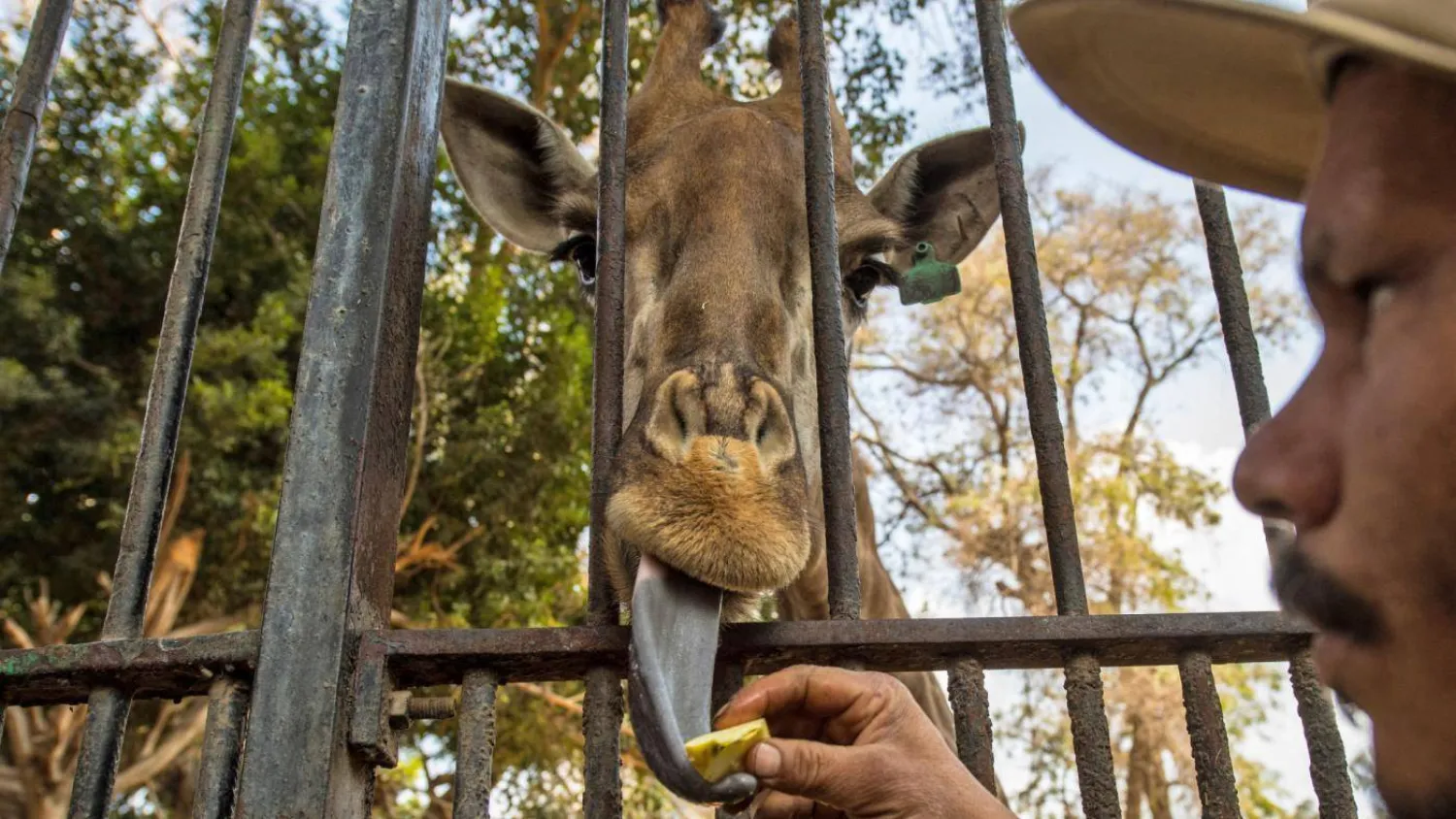

Egypt Pledges to Protect 'Rare Trees' in Giza Zoo

An Egyptian zoo keeper feeds a giraffe at Giza Zoo in Cairo, on
20 February 2019 (AFP)
An Egyptian zoo keeper feeds a giraffe at Giza Zoo in Cairo, on 20 February 2019 (AFP)
TT

Egypt Pledges to Protect 'Rare Trees' in Giza Zoo

An Egyptian zoo keeper feeds a giraffe at Giza Zoo in Cairo, on
20 February 2019 (AFP)
An Egyptian zoo keeper feeds a giraffe at Giza Zoo in Cairo, on 20 February 2019 (AFP)

The Egyptian government has pledged to protect the “rare plants” in the Giza Zoo. In an official press release on Saturday, the Egyptian Council of Ministers addressed the news circulating on some websites and social media pages about “the uprooting of rare trees in the Giza Zoo as part of its development project.”

The Giza Zoo was built by Khedive Ismail, who used the royal land, first to host Egypt’s guests for the opening of the Suez Canal in 1869, and then, to establish the first zoo in the country and the second in the world following the London Zoo (established in 1828). The Giza Zoo was officially opened by Khedive Tewfik, who continued the project and inaugurated it in 1891.

Stretching over 80 acres, the zoo includes some “rare” trees and plants exported from different regions around the world, as well as animals, historic establishments and museums including the animal museum, which displays a collection of embalmed birds hunted and gifted by King Farouk.

The council of ministers said in a statement on Saturday, “the reports on uprooting ‘rare’ trees are groundless, and all the rare trees and plants in the zoo will remain intact.”

Egyptian President Abdel Fattah El-Sisi called for “a development project that meets the international standards in the Giza Zoo”. During a demonstration of the project with government officials in January, Sisi stressed “the importance of adopting international environmental standards in the zoo, and turning it into an attractive destination that accommodates visitors from all Egyptian governorates.”

“The Giza Zoo is witnessing an inclusive development plan that aims at improving all its services, preserving rare plants and trees, recalling its historic aspect, and transforming it into a high-standard, barrier-free, open zoo while maintaining the highest international security measures to ensure the safety of the visitors. The plan, which also consists of linking the zoo to the Orman Garden with the help of global experts, has been set by one of the best specialized consultants in the world,” said the Egyptian Ministry of Agriculture and Land Reclamation in a statement.

The Giza Zoo has been a touristic entertainment center for years. Under the rule of King Farouk, it served as royal rest house that received visitors and high-profile guests, including the late Saudi King Abdulaziz Al Saud, whose picture are displayed there.

The zoo includes the animal museum, which displays a collection of embalmed birds gifted by King Farouk, as well as a collection of “rare” animals that were embalmed after their deaths, the last of which was a rhinoceros that died in 2020. The zoo also embraces about 38,000 trees, including ‘rare’ species.



Saudi Arabia, Kuwait Strengthen Cooperation in Combating Desertification and Restoring Lands

The center is holding five specialized workshops on combating desertification - SPA/File photo
TT

Saudi Arabia, Kuwait Strengthen Cooperation in Combating Desertification and Restoring Lands

The center is holding five specialized workshops on combating desertification - SPA/File photo

The National Center for Vegetation Cover Development and Combating Desertification, in cooperation with Kuwait's Environment Public Authority, has launched a series of virtual training and technical workshops in September and October 2026 as part of the implementation of a memorandum of understanding between Saudi Arabia and Kuwait on environmental protection, rehabilitation, and conservation.

The center is holding five specialized workshops on combating desertification and restoring degraded land, contributing to the development of policies and strategies to address desertification and reduce land degradation, support decision-making, and protect and sustain ecosystems, SPA reported.

The workshops will highlight the importance of green belts in mitigating sand encroachment and showcase the Kingdom’s experience in the integrated management of invasive plant species, as well as the results achieved in this field.

The initiative reflects the Kingdom’s commitment to enhancing cooperation and sharing expertise to combat desertification, restore degraded lands, and improve methods for assessing land degradation. It also supports efforts to protect ecosystems, advance the goals of Saudi Vision 2030, and contribute to global climate action.


Avalanche Hits Glacier on China's Muztagh Ata in Xinjiang

People walk through a flood-affected area in Devighat, Nuwakot district, Nepal, 05 September 2026. EPA/NARENDRA SHRSTHA
TT

Avalanche Hits Glacier on China's Muztagh Ata in Xinjiang

People walk through a flood-affected area in Devighat, Nuwakot district, Nepal, 05 September 2026. EPA/NARENDRA SHRSTHA

An avalanche struck Glacier No. 2 on Muztagh Ata, near China's border with Tajikistan in the northwestern Xinjiang region, with several tourists capturing footage on their phones, state broadcaster CCTV reported on Sunday.

Video showed a massive wall of snow and ice ⁠cascading down the mountainside, ⁠forming a snow cloud more than 100 meters (328 feet) wide, the broadcaster said.

There were no casualties or property damage ⁠because the avalanche took place in an unpopulated area far from major roads, CCTV reported, according to Reuters.

The main peak of Muztagh Ata, covered by ice and glaciers, is 7,546 meters high. Glacier No. 2 is closed to the public because ⁠of ⁠heightened risks of glacial activity.

The local culture and tourism bureau on Saturday warned tourists not to enter unauthorized high-risk restricted zones on Muztagh Ata, citing complex terrain, volatile weather, weak communication signals and extremely poor rescue conditions.


Indonesia Cancels Flights at Jakarta Airport, Others as Anak Krakatau Volcano Erupts

In this drone photo released by the Geological Agency (Badan Geologi) of Indonesia's Ministry of Energy and Mineral Resources, Mount Anak Krakatau spews volcanic smoke in Sunda Strait, Indonesia, Saturday, Sept. 5, 2026. (Badan Geologi via AP)
TT

Indonesia Cancels Flights at Jakarta Airport, Others as Anak Krakatau Volcano Erupts

In this drone photo released by the Geological Agency (Badan Geologi) of Indonesia's Ministry of Energy and Mineral Resources, Mount Anak Krakatau spews volcanic smoke in Sunda Strait, Indonesia, Saturday, Sept. 5, 2026. (Badan Geologi via AP)

Indonesia’s Anak Krakatau volcano erupted early Sunday, prompting the cancellation of all flights at Jakarta’s Soekarno-Hatta International Airport and disrupting other domestic airports as volcanic ash drifted across parts of western Indonesia.

Indonesia’s Geological Agency said the volcanic island located in Indonesia’s Sunda Strait between the main Java and Sumatra islands had showed signs of activity since Friday before erupting for 30 seconds at 3:53 a.m. Sunday. Closed-circuit camera footage showed lava flares from the volcano.

No casualties were reported and no evacuation order was issued, The Associated Press reported. The nearest settlement is more than 16 kilometers (10 miles) away, but authorities warned residents and visitors to stay at least 3 kilometers (2 miles) from the active crater.

Volcanic ash spread across parts of Jakarta and Lampung province on Sumatra’s southern tip, Indonesia’s Center for Volcanology and Geological Hazard Mitigation said.

AirNav Indonesia closed airspace around Soekarno-Hatta and Halim Perdanakusuma airports in Jakarta, as well as four other airports, including Radin Inten II Airport in Lampung, because of volcanic ash.

Thousands of passengers affected By mid-afternoon, the closure had affected 516 flight movements, with 202 in Jakarta’s Soekarno-Hatta airport alone that affected about 22,800 passengers, on Sunday. The airport was ordered closed until at least 5:30 p.m.

Indonesia’s Directorate General of Civil Aviation said it was closely monitoring the eruption's impact on air travel and coordinating with airlines, airport operators, air navigation services and the meteorology agency.

“Safety remains our top priority in every operational decision,” Lukman F. Laisa, Ministry of Transportation director general of civil aviation, said in a statement.

He warned flight schedules could face cascading disruptions affecting aircraft rotations, fleet availability and terminal capacity as airlines work to restore operations.

The eruption also disrupted services at Bali’s I Gusti Ngurah Rai International Airport and at Medan.

Volcano remains active Indonesia’s volcanology agency and the Darwin Volcanic Ash Advisory Centre identified two ash clouds using satellite imagery. One plume rose to 20,000 feet (6,100 meters) and drifted northeast over Jakarta, Banten, West Java and nearby waters. A second cloud reached 50,000 feet (15,200 meters) and spread over parts of Banten, Lampung and Bengkulu provinces, the southern Sunda Strait and sections of the Indian Ocean west of Sumatra.

Lana Saria, head of Indonesia’s Geological Agency, said activity at Anak Krakatau has intensified since July, with Sunday’s eruption the strongest during the current period of unrest.

The repeated eruptions indicate a continued supply of magma and volcanic gases beneath the volcano, she said, though officials cannot predict whether a larger eruption will occur.

“We continue to evaluate the volcano’s development based on all monitoring data, not solely on the number of eruptions or the height of the ash column,” Saria said in a video briefing.

She said the main hazards include volcanic ash, high concentrations of gas and the ejection of hot rocks and other material around the crater area.