Egyptian farmer Makhluf Abu Kassem, center, sits with farmers under shade of a dried up palm tree surrounded by barren wasteland that was once fertile and green, in Second Village, Qouta town, Fayoum, Egypt, Wednesday, Aug. 5, 2020. AP
Egyptian farmer Makhluf Abu Kassem, center, sits with farmers under shade of a dried up palm tree surrounded by barren wasteland that was once fertile and green, in Second Village, Qouta town, Fayoum, Egypt, Wednesday, Aug. 5, 2020. AP
In the winter of 1964, Makhluf Abu Kassem was born in this agricultural community newly created at the far end of Egypt’s Fayoum oasis. His parents were among the village’s first settlers, moving there three years earlier from the Nile Valley to carve out a new life as farmers.
It was a bright and prosperous start. The region was fertile, and for four decades they made their living growing corn, cotton and wheat, The Associated Press reported.
Now 55, Abu Kassem looks out what’s left of his shriveling farm, surrounded by barren wasteland that was once his neighbors’ farmland — victims of dwindling irrigation in recent years.
“There used to be enough water to make all this area green. ... Now, it is as you see,” he said.
In the past, he and other villagers irrigated their farms through canals linked to the Nile River, Egypt’s lifeline since ancient times. It provides the country with a thin, richly fertile stretch of green land through the desert.
But there has been a loss of at least 75% of farmland in the village and the surrounding areas, according to Abdel-Fattah el-Aweidi, head of Gazaer Qouta Agriculture Association, overseeing the area.
Now, Abu Kassem fears that a dam Ethiopia is building on the Blue Nile, the Nile’s main tributary, could add to the severe water shortages already hitting his village if no deal is struck to ensure a continued flow of water.
“The dam means our death,” he said.
The exact impact of the dam on downstream countries Egypt and Sudan remains unknown. For Egyptian farmers, the daunting prospect adds a new worry on top of the other causes of mounting water scarcity. Egypt is already spreading its water resources thin. Its booming population, now over 100 million, has one of the lowest per capita shares of water in the world, at around 550 cubic meters per year, compared to a global average of 1,000.
Ethiopia says the electricity that will be generated by its Grand Ethiopian Renaissance Dam is a crucial lifeline to bring its nearly 110 million citizens out of poverty.
Egypt, which relies on the Nile for more than 90% of its water supplies, including drinking water, industrial use and irrigation, fears a devastating impact if the dam is operated without taking its needs into account.
It wants to guarantee a minimum annual release of 40 billion cubic meters of water from the Blue Nile while Ethiopia fills the dam’s giant reservoir, according to an irrigation official. That would be less than the 55 billion cubic meters Egypt usually gets from the Nile, mostly from the Blue Nile. The shortage would be filled by water stored behind Egypt’s Aswan High Dam in Lake Nasser, which has a gross capacity of 169 billion cubic meters of water.
“If the dam is filled and operated without coordination between Egypt and Ethiopia, its impact will be destructive to the whole Egyptian society and the state will not be able to address its repercussions,” said Egypt’s former Irrigation Minister Mohammed Nasr Allam.
It is estimated that a permanent drop of 5 billion cubic meters of Nile water to Egypt would cause the loss of 1 million acres of farmland, or 12% of the country’s total, he said.
Sudan says the project could endanger its own dams, though it would also see benefits from the Ethiopian dam, including cheap electricity and reduced flooding.
On Abu Kassem’s 16-acre farm, only a single acre is now cultivated. His family tried growing corn, but the plants died. They, like most others in the area, switched to growing olive trees, which use less water. But even those suffer.
“These trees haven’t seen water in over 40 days,” Abu Kassem said, showing a shriveled fruit.
With the water waning, many of the village’s 12,000 people have left, including Abu Kassem’s three brothers and his four sons.
Ihsan Abdel-Azim, 53, the wife of one of Abu Kassem’s brothers, moved with her family to work as doormen in Cairo in 2001.
“We had had no choice at the time,” AP quoted the mother of five as saying, sitting among her grandchildren during a visit to the village earlier this month. “Cultivating the farm became insufficient to feed my children. All roads led that way.”
Years-long negotiations among Egypt, Sudan and Ethiopia failed to reach a deal on the dam. The dispute reached a tipping point earlier this week when Ethiopia announced it completed the first stage of the filling of the dam’s 74 billion-cubic-meter reservoir.
That sparked fear and confusion in Sudan and Egypt. Both have repeatedly insisted Ethiopia must not start the fill without reaching a deal first.
Ethiopian Prime Minister Abiy Ahmed said the filling occurred naturally, “without bothering or hurting anyone else,” from torrential rains flooding the Blue Nile.
Sticking points in the talks have been how much water Ethiopia will release downstream during the filling if a multi-year drought occurs and how the three countries will resolve any future disputes. Egypt and Sudan have pushed for a binding agreement, while Ethiopia insists on non-binding guidelines.
What to Know about the Legacy of Brexit, Which Still Divides Britain 10 Years onhttps://english.aawsat.com/features/5286777-what-know-about-legacy-brexit-which-still-divides-britain-10-years
A placard is held as people walk past the Elizabeth Tower, commonly known as Big Ben, during the National Rejoin March IV organized by National Rejoin March (NRM), marking ten years since Britain voted to leave the European Union in 2016 and calling for closer cooperation between Britain and Europe, in London, Britain, June 20, 2026. (Reuters)
TT
TT
What to Know about the Legacy of Brexit, Which Still Divides Britain 10 Years on
A placard is held as people walk past the Elizabeth Tower, commonly known as Big Ben, during the National Rejoin March IV organized by National Rejoin March (NRM), marking ten years since Britain voted to leave the European Union in 2016 and calling for closer cooperation between Britain and Europe, in London, Britain, June 20, 2026. (Reuters)
Ten years ago, the United Kingdom voted to leave the European Union in a referendum that forges political identities to this day and that shattered a half-century project to get closer to the continent.
Brexit, short for British exit, became a reality on June 23, 2016, when 52% — or more than 17 million people — voted to leave the EU. Though the margin was narrow, the vote led to the most dramatic shake-up of the UK economy and society since World War II.
But like any divorce, the paperwork and process of completing the breakup was not swift: It took nearly five years.
Brexit was born out of a growing sense of frustration not only with the EU but over the global financial crisis of 2008. Supporters were able to tap into that frustration, and argued that the UK on its own, would be revitalized and able to focus just on domestic priorities.
Opponents warned that Brexit would lead to an economic disruption and that it risked the country’s standing in the world.
A decade on, here is where Brexit stands.
Brexit ushered in a harsh economic reality
Backers of Brexit — commonly known as Brexiters — held out a vision that the British economy could thrive outside the EU by harnessing the buccaneering spirit that had once made it the world’s biggest.
Though the COVID-19 pandemic and the wars in Ukraine and more recently, the US-Israeli war on Iran have not helped, it’s clear that the British economy has not been revitalized.
Merchants have complained about the hurdles that they now have to clear when trading with their European neighbors — the 27-nation EU remains by far the UK’s biggest trading partner.
And though there are no tariffs imposed on British goods entering the EU, there is a raft of non-tariff barriers, such as cumbersome customs paperwork, border certifications, and visa restrictions. Many of the trade deals that the Brexiters touted, most notably one with the United States, have not materialized.
Experts say the British economy is between 4% and 8% smaller than it would have been had the country voted to remain in the EU. That would translate to much higher living standards and billions more pumped into public services, including the cherished National Health Service, which was promised an extra 350 million pounds ($468 million) a week by Brexit campaigners. That pledge was emblazoned on their big red campaigning bus.
“Brexit has made the UK economy smaller than it otherwise would have been,” said Jonathan Portes, professor at King’s College London.
“The effect has not been a sudden collapse, but a gradual and cumulative drag on trade, investment and productivity,” he wrote in an article for The UK in a Changing Europe think tank.
Brexiters argue, however, that leaving the EU is not something that can be judged in the short-term — there was always going to be a short-term economic disruption in return for greater control over an array of policy levers, including on migration.
The uproar over immigration is escalating
Brexit put an end to free movement between the UK and EU, but securing Britain's border has had mixed outcomes. Getting a grip on immigration was a key promise of the Brexiters — their message of taking back control resonated.
Though net migration — the difference between those entering the UK and those leaving in any one year, from Europe — has plunged, it has soared from non-EU countries. That’s partly because of changes in visa rules that the previous Conservative government introduced to help out sectors that desperately needed migrant labor, such as workers to care for the elderly.
Overall though, there are signs the government is getting a grip on who can and cannot enter the country legally. Net migration has fallen sharply, from more than 900,000 in 2023 to 171,000 last year.
Though net migration is down, many are angered by migrants entering the country illegally — specifically the sight of people, often escaping war zones such as Afghanistan and Sudan, arriving on British shores in inflatable boats after making the dangerous journey across the English Channel.
The uproar over the number of small boat crossings, which peaked at 46,000 in 2022 and reached 41,000 last year, has become one of the main top political issues despite being a fraction of overall migration. Anger has focused on asylum seekers, often housed at public cost. Unruly mobs have protested outside and even tried to set fire to some hotels housing asylum seekers.
Voters have expressed remorse
In the years since Brexit, Britain's political landscape has fractured, with declining support for the two long-dominant parties, Conservatives and Labour. The Conservatives were ejected in 2024 after 14 years in power, much of it dominated by wrangling over UK-European relations.
The Labour government hasn’t impressed either and Prime Minister Keir Starmer looks like he will be announcing his resignation very soon.
Millions of voters are being tempted by Reform UK, led by Nigel Farage, who perhaps more than any other politician campaigned for Brexit. His party has led in almost every opinion poll for more than a year.
At the same, there’s a growing feeling in the country that Brexit has failed.
According to two polls from Ipsos, 52% of people in the UK would like to rejoin the EU while 33% are against it. The pollster also found that 48% think Brexit is going worse than expected against just 9% who think it’s going better. Also, Ipsos found that 48% would back another referendum today on the UK’s membership of the EU against 27% who oppose one.
A reset would be complicated
Against this backdrop, the Labour Party has walked a tightrope since being elected in 2024. Having explicitly ruled out reversing Brexit — or even rejoining the EU’s frictionless single market — it hasn’t got a huge amount of political space to maneuver.
Starmer has sought a “reset” of ties following the distrust built over the years of the Brexit negotiations, largely centered around making trading easier. He is hoping to announce further measures at a summit with the EU next month — provided he’s still the prime minister.
His most likely successor, Andy Burnham, tempered his language on the UK rejoining the EU while out on the campaign trail over the past month, ahead of his victory in a special election on Thursday that saw him beat back a challenge from Reform in a seat that overwhelmingly backed Brexit.
“I am not proposing that the UK considers rejoining the EU,” Burnham said. “I respect the decision that was made at the referendum and it is going to undermine everything I have said about strengthening democracy if we don’t respect that vote.”
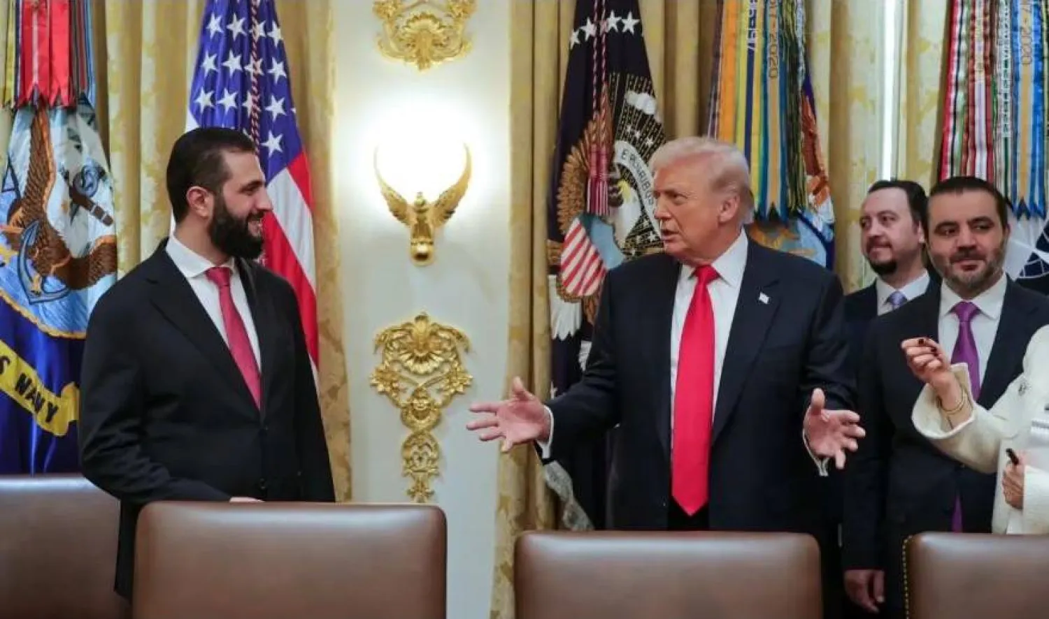
How Damascus, Beirut and Tel Aviv View Trump's Call for Syrian Intervention in Lebanonhttps://english.aawsat.com/features/5286423-how-damascus-beirut-and-tel-aviv-view-trumps-call-syrian-intervention-lebanon
How Damascus, Beirut and Tel Aviv View Trump's Call for Syrian Intervention in Lebanon
US President Donald Trump's repeated remarks in recent days that he had asked President Ahmed Al-Sharaa to have Syria intervene against Hezbollah in Lebanon have been met with rejection in Damascus, concern in Beirut, and little serious consideration in Tel Aviv.
Syria, which dominated Lebanon after sending its forces there in 1976, appears to have no intention of repeating that experience today. "We view our role through supporting the Lebanese state's exercise of its authority," Ahmed Zeidan, media adviser to the Syrian president, told Asharq Al-Awsat in an exclusive statement.
Israel, meanwhile, views Trump's proposal as unserious and as a pointed jab at Benjamin Netanyahu's government, which has been unable to conclude the war against Hezbollah without inflicting widespread destruction on Lebanon. Although Tel Aviv does not appear concerned about an imminent Syrian military intervention in Lebanon, it believes that any such move would also mean an expansion of Turkish influence. According to Israeli Diaspora Affairs Minister Amichai Chikli, Syria and Türkiye "pose a far greater concern than Iran."
By contrast, Beirut moved quickly to reject any Syrian or foreign involvement in the Hezbollah situation, stressing that dealing with the issue remains exclusively the responsibility of the Lebanese state and its institutions.
Asharq Al-Awsat examines the implications of Trump's call for Syrian military intervention in Lebanon through three reports from Damascus, Beirut and Tel Aviv.
Syrian Official: We Have No Desire to Enter Lebanon
Damascus has reiterated that it has no desire to intervene militarily in Lebanon. At the same time, it called on Lebanon's Hezbollah to cease its involvement in Syria, whether "through direct intervention or through supporting and sheltering remnants of the former regime, the killers of the Syrian people," according to Ahmed Zeidan, media adviser to the Syrian president, in an exclusive statement to Asharq Al-Awsat.
He also stressed that "the doors of Damascus and the People's Palace remain open to all Lebanese groups."
Zeidan said: "We reaffirm once again that we see our role through supporting the Lebanese state's exercise of its authority." He added that "those who remain governed by the mentality and thinking of 1976, the year Syrian forces entered Lebanon, should understand that today we are in the moment of December 8, 2024, the date of the fall of Bashar al Assad's regime, the moment of a new Syria."
The new Syrian approach toward Lebanon is based on "enabling the state to exercise its authority and sovereignty over all Lebanese territory, far removed from the mentality and practices of militias, whose interventions have imposed a heavy cost on Lebanon, Syria and the region," Zeidan said. He explained that Damascus is working "toward strengthening the Lebanese state's authority and sovereignty."
The second pillar of Syria's approach toward Lebanon, he added, is "a development-oriented approach, because development strengthens the state, reinforces social cohesion, and keeps away those who seek to exploit or prey upon Lebanon."
Responding to Trump's repeated calls for Syria to intervene militarily in Lebanon against Hezbollah, Zeidan said: "We have already stated and explained our position. Our role lies in supporting the Lebanese state and supporting development that will bring benefits to Lebanon and the region."
He added: "What Syria wants for Lebanon is what any neighbour wants for another neighbour. Lebanon, as a state, must exercise its authority and assume responsibility for restraining Hezbollah's militias from interfering in Syrian affairs. As we say, if your neighbour is well, then you are well. Thank God, Syria is doing well, and everyone can see that. Therefore, our neighbours after December 8, 2024, are doing well too. In return, we hope that our brothers in Lebanon will live in prosperity under the authority of a single state."
Since the fall of Bashar al Assad's regime, Damascus has opened a new chapter in relations with Lebanese state institutions, ending the era of tutelage over Lebanon. During that period, a complex network of political, security and economic relationships emerged, built around the intertwined interests of the ruling classes in both countries as a result of Syria's 29 year military presence in Lebanon from 1976 to 2005. During those years, Lebanese state institutions weakened while Hezbollah's influence expanded. The group later became deeply involved in the Syrian conflict alongside Bashar al Assad's regime as part of the Iranian axis.
There are widespread concerns within Syrian circles about the prospect of intervention in Lebanon after breaking free from the Assad regime and embarking on a path of balanced policymaking within a regional alignment that supports Syria's aspiration to preserve its territorial unity and establish stability. This approach, by definition, entails distancing itself from the region's conflicts.
One of the principal risks of intervention in Lebanon would be the rekindling of sectarian tensions and civil strife, particularly given the possibility that Shiite militias in Iraq could launch attacks against Syria, or that Iran and Hezbollah could activate their networks inside the country, political and military researcher Rashid Hourani told Asharq Al-Awsat. He noted that Iran and its allies "have succeeded in building extensive networks across Syria because of the length of their involvement there."
Regarding the potential impact of intervention on the new framework of Syrian-Lebanese relations, Hourani said that Syria's relationship with the Lebanese state "is separate from its relationship with Hezbollah. The Lebanese government has disavowed the party's security and military actions and movements, and has declared them illegitimate."
According to Hourani's analysis, Trump's repeated statements that he had asked the Syrian President for help against Hezbollah appear to conceal "an American desire to separate the Hezbollah issue from the relationship with Iran after reaching an agreement with Tehran, while indirectly or unofficially capitalizing on the consequences of Hezbollah's military intervention in Syria."
He argued that Syria could intervene if "there were a greater interest in doing so than in staying out," citing as an example the possibility of securing an Israeli withdrawal from southern Syria. He pointed to reports by the Israeli Public Broadcasting Corporation that "Washington is pressuring Syria and Israel to resume negotiations after several months of deadlock."
Hourani said that the possibility of negotiations resuming alongside Trump's statements "suggests the possibility of reaching some form of agreement, in addition to the likelihood that any mission would be clearly limited in time, from start to finish."
He added that Syria could also enter Lebanon if "Iran continues its attempts to restore its influence in Syria, with Hezbollah assisting in those efforts." He noted that the Syrian Interior Ministry has, over recent months, blamed Hezbollah for acts of sabotage in several Syrian cities.
In light of these considerations, Wael Alwan, a researcher at the Jusoor Center for Studies who is close to the Syrian government, did not rule out a future Syrian role in Lebanon, sooner or later. However, he stressed that it would not be in the manner suggested by the American president's remarks.
He predicted that any such role would take place in coordination with the Lebanese government and the Lebanese Army, and would be "limited to what is necessary, both geographically and in duration, for the purpose of protecting Syria's borders and the areas adjacent to them."
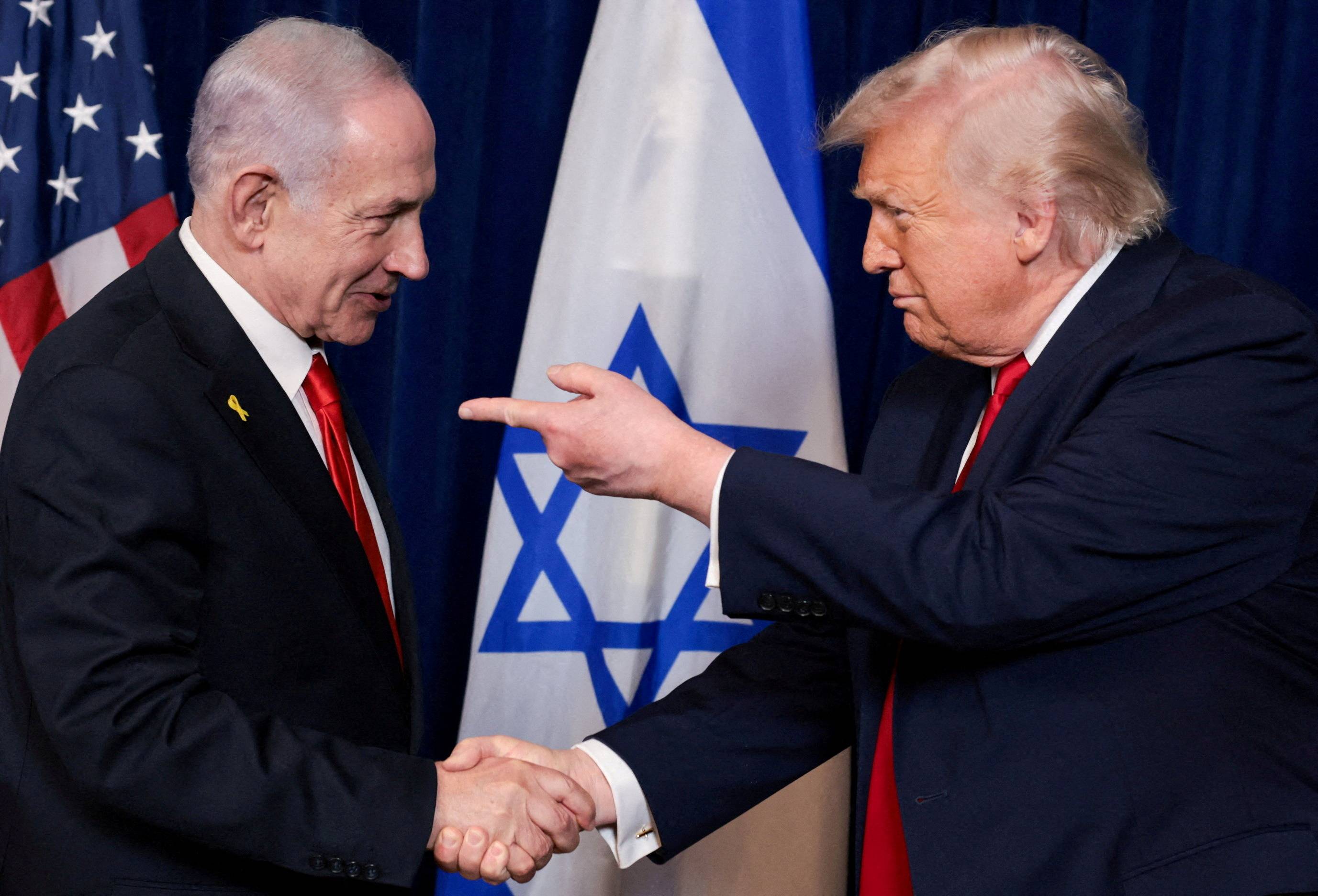
US President Donald Trump points his finger towards Israeli Prime Minister Benjamin Netanyahu as they shake hands during a press conference after meeting at Trump’s Mar-a-Lago club in Palm Beach, Florida, US, December 29, 2025. REUTERS/Jonathan Ernst/File Photo
Israel Does Not Take Seriously the Idea of Tasking Syria With Dismantling Hezbollah
At first glance, Israel was taken aback by the US president's remarks about assigning Syria the task of disarming Hezbollah. However, after brief consultations with intelligence chiefs, Israeli officials concluded that the idea was detached from reality and should not be taken seriously. Nevertheless, experts and some politicians argued that the political significance of the proposal should not be underestimated.
In their view, it amounted to a "a pointed jab" from the US administration, which has grown weary of Prime Minister Benjamin Netanyahu's policies and his efforts to drag the region from one long war into an even longer one. The United States has never been fond of protracted wars, viewing them as a burden, and believes that every war should have a clearly defined endpoint.
This position has been expressed openly and without ambiguity in recent weeks. The Wall Street Journal published a report stating that Trump has grown weary of Netanyahu's repetition and persistence. The report explained that during the many phone conversations between the two men, the same tedious scene kept recurring: Netanyahu repeating his positions while Trump listened. Hebrew language media went further, reporting that "from time to time Trump would raise his voice, refuse, rebuke, berate and curse.
Maariv added that Trump had previously tended to believe what Netanyahu told him, but in recent months he has begun taking notes and asking his aides: "Is what he said true? Is what he is saying accurate?"
For the sake of precision, Trump's comments about Syria's role in Lebanon consisted of a single statement: "If Israel can't do the job without killing everyone else, Syria should do the job." The media focused on the second part of that statement and largely ignored the first, which is the more important point.
The US president was criticizing Netanyahu for continuing to pursue war, for failing to achieve his objectives, and for what he viewed as excessive killing and destruction. He reinforced that criticism later when he asked: "Why do you have to destroy apartment buildings?" He then noted that many of the Lebanese killed in Israeli operations were neither members of Hezbollah nor connected to the group.
Writing in Haaretz, Middle East analyst Dr. Zvi Bar'el, the newspaper's Arab affairs editor, dismissed the notion of drawing Syria into Lebanon. He said Israel should understand by now that Trump does not share its view of the Lebanese arena, which is rapidly being transformed from an Israeli battlefield into a diplomatic bargaining chip for Iran, in a game that Trump has effectively already conceded. In addition to Iran's desire to preserve Hezbollah's standing and authority, Lebanon has also become an integral part of the tangible guarantees Tehran is seeking from the United States to demonstrate its ability to honor its commitments.
Bar'el argued that the proposal to transfer responsibility for dealing with Hezbollah from Israel to a Syrian contractor is reminiscent, to some extent, of the far fetched idea of activating Kurdish militias to help overthrow the regime in Iran, a proposal that collapsed only days after it was floated. He pointed out that although Syrian President Ahmed Al-Sharaa has a strong motive to crush Hezbollah, given his long history of hostility toward the group, he has already stated that he has no interest in such a project.
Bar'el added that military involvement in Lebanon is not a realistic option for the Syrian president at a time when Syria continues to suffer from violence and has yet to achieve military and administrative stability. He noted that Al-Sharaa recently made clear that the era of Syrian military intervention in Lebanon is over.
At the same time, Israelis generally view the new leadership in Damascus with suspicion, seeing it as part of a Turkish project that threatens Israel. They believe that if Damascus were to accept Trump's proposal, it would gain additional support from Washington, potentially at Israel's expense.
Israeli Diaspora Affairs Minister Amichai Chikli has even gone so far as to threaten war against Syria "sooner or later," claiming that Syria and Türkiye "pose a far greater concern than Iran." Although Chikli occupies a relatively minor position in Netanyahu's government, the remarks he made on Thursday to Radio 103FM, affiliated with the Hebrew newspaper Maariv, reflect a broader political mood within the government and help explain its obstruction of negotiations with Damascus.
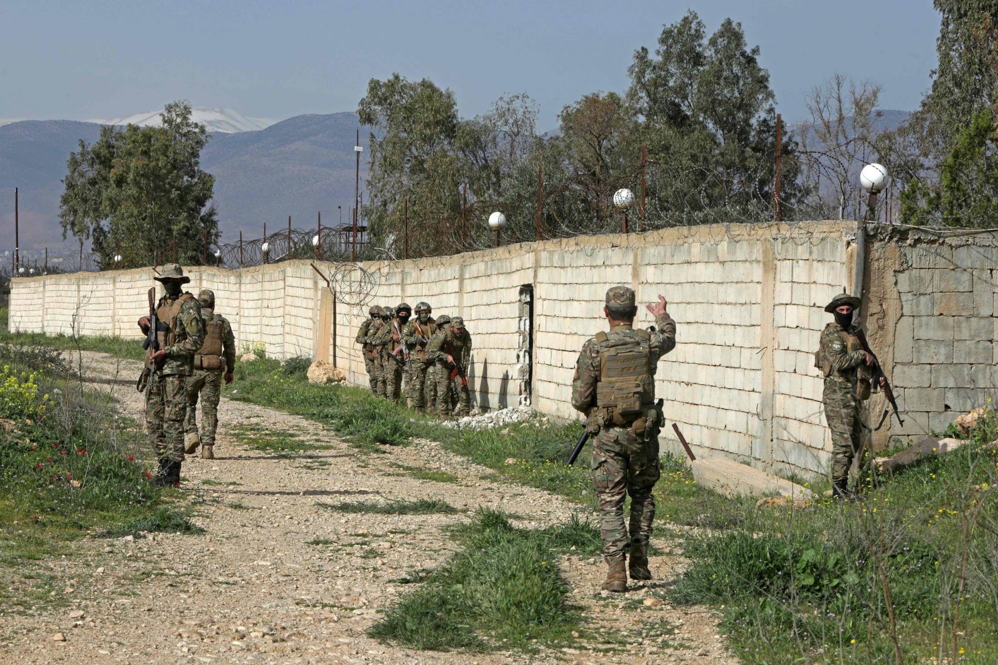
Syrian army soldiers patrol along the Syrian Lebanese border in the rural area of Al Qusayr on April 1, 2026. (Photo by Bakr ALKASEM / AFP)
Beirut: Dealing With Hezbollah's Weapons Remains Solely the Responsibility of the Lebanese State
Trump's remarks about discussing Hezbollah with Al-Sharaa have raised questions in Lebanon about the possibility of assigning Damascus a role in confronting the group. However, Lebanese official and political positions have largely aligned with Syrian opposition to the idea.
Beirut moved quickly to reject any Syrian or foreign intervention in the matter, stressing that addressing the issue remains exclusively the responsibility of the Lebanese state and its institutions.
Speaking during the G7 summit in France, Trump said he had discussed Hezbollah with Al-Sharaa. When asked whether the Syrian president was prepared to confront the group, he merely replied that he would speak about the matter later.
An Attempt to Accommodate Israeli Realities
In this context, former Lebanese Deputy Speaker Elie Ferzli argued that Trump's remarks cannot be understood as part of a coherent strategic vision. Rather, they should be viewed within the framework of short term political considerations linked to recent developments in the region.
Ferzli told Asharq Al-Awsat: "I place these remarks by President Trump in a tactical rather than a strategic context. You cannot interpret them strategically after the agreement that was signed with Iran, nor can you interpret them strategically in light of everything that has taken place across the region."
He added: "Nor can you understand them strategically when Türkiye has already expressed a specific position regarding what is taking place in southern Syria."
Ferzli said that the reading closest to reality is to view these statements as part of managing the postwar political landscape. "This is a tactical statement aimed at accommodating the Israeli reality and avoiding the appearance that Israel has paid a price or made concessions voluntarily," he said.
He added that the current regional climate does not encourage the creation of new flashpoints of tension in Lebanon.
The Lebanese Army and Internal Stability
Ferzli did not limit himself to questioning the practicality of the American proposal. He linked it directly to Lebanon's domestic situation and the role of its official institutions, warning of the consequences of any approach that bypasses the Lebanese state.
"I believe that the most important issue of all is that the Lebanese Army cannot stand by as a spectator in this matter, because it affects the very structure of the Lebanese entity and the foundations of the political system," he said. "Therefore, it cannot be treated as a passing detail, given the direct repercussions it could have on Lebanon and its stability."
Disarmament Is the Responsibility of the Lebanese State
In contrast to the proposal hinted at by Trump, Lebanese Justice Minister Adel Nassar took a firm position in support of keeping security decisions exclusively in the hands of the Lebanese state. Nassar said in an interview with CNN that the disarmament of Hezbollah is the responsibility of the Lebanese state, not foreign forces.
What We Did Not Accept Under Assad, We Will Not Accept From Any Other Regime
Nassar's position aligns with that of Richard Kouyoumjian, former minister and head of foreign relations for the Lebanese Forces party. Kouyoumjian dismissed the idea that Syria even has an interest in playing such a role and rejected in principle any Syrian intervention in Lebanese affairs.
Kouyoumjian told Asharq Al-Awsat: "The information available to us, whether through our meetings with the Syrian side, our contacts with the Syrian ambassador in Lebanon, or through the public statements of President Ahmed Al-Sharaa and Syrian officials, indicates that this is simply not under consideration."
He added: "The Syrian side neither wants, nor is enthusiastic about, nor is fundamentally convinced of becoming involved in Lebanon's internal affairs, especially on an issue as sensitive and dangerous as Hezbollah's weapons."
He stressed that "there is a firmly established conviction on the Lebanese side, particularly within the Lebanese state, that it bears responsibility for the weapons issue." He noted that "decisions on this matter were taken during the past year, and this was also clearly reflected in the ministerial statement of the current government."
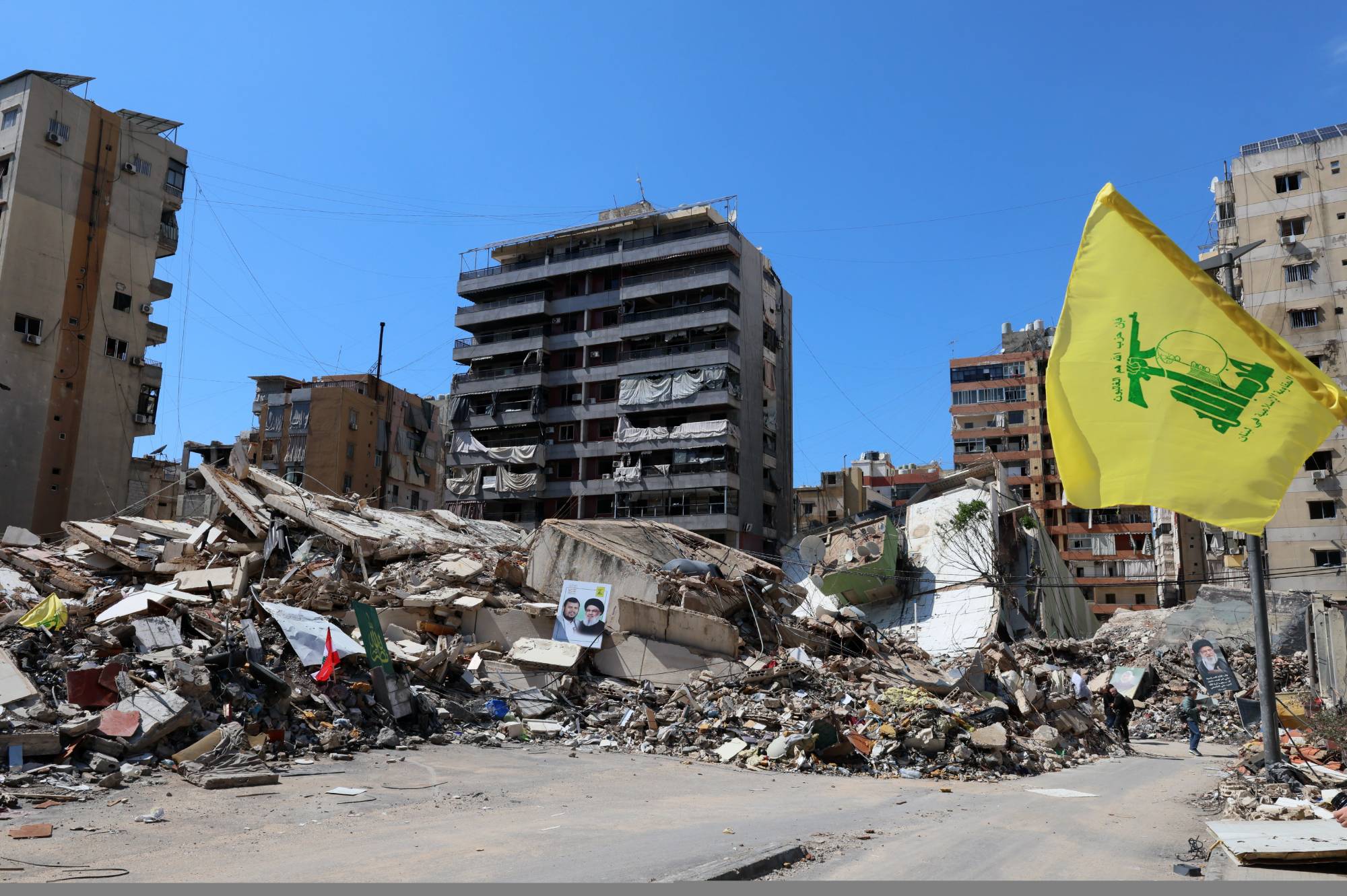
Rubble from buildings destroyed by Israeli airstrikes during a press tour organized by the Hezbollah media office in the Ruwais neighborhood, southern suburbs of Beirut, Lebanon, 06 May 2026. EPA/WAEL HAMZEH
He said the Lebanese sovereignty is not something that can be infringed upon or compromised. As for Syria, despite the long history between the two countries, and regardless of the fact that the current government is not hostile toward Lebanon, quite the contrary, we are doing our best to put relations with it in order following the end of the former regime. Nevertheless, there appears to be neither a desire, nor a will, nor a decision on the Syrian side to intervene in Lebanon. In fact, the opposite is true.
He also stressed that "the Lebanese state, the Lebanese people, and Lebanese political parties all reject any Syrian intervention in Lebanon, regardless of the nature of the government in Damascus."
Kouyoumjian argued that the issue of Hezbollah's weapons must be handled through Lebanese institutions, saying: "We call on the Lebanese state to settle this matter and assume responsibility for addressing the issue of disarmament. If it requires Arab or international support, then it is the Lebanese state that should request such support, whether through the United Nations or through the appropriate international mechanisms."
He concluded: "We believe that the Lebanese state, through its own capabilities, institutions, and agencies, is capable of carrying out this responsibility. Therefore, there is no need for any external intervention. What is required is for the Lebanese state to be decisive, willing, and determined to exercise its full authority and ensure Lebanese sovereignty over all its territory."
The Kataeb Party has also joined those rejecting any Syrian role in addressing Hezbollah's weapons issue, stressing that "placing all weapons exclusively under the authority of the Lebanese state and extending its full authority over all Lebanese territory remain the fundamental gateway to resolving this issue."
In a statement, the party said that any proposal based on "direct Syrian intervention to achieve this objective is unacceptable." It argued that the process should take place "within a clear framework that respects Lebanese sovereignty, strengthens the role of legitimate institutions, and is accompanied by support from Lebanon's regional and international partners in a manner that serves only the interests of the Lebanese state."
The party also welcomed the position previously expressed by Syrian President Ahmed Al-Sharaa rejecting military intervention in Lebanon, considering that stance to "reflect respect for Lebanon's sovereignty and independence and to lay the groundwork for healthy relations between the two countries."
For its part, the Free Patriotic Movement rejected any proposal that would assign a security or military role within Lebanese territory to a foreign state, including suggestions that Syrian authorities could be tasked with confronting Hezbollah inside Lebanon. The movement also praised the Syrian President's rejection of any military or political intervention in Lebanon, stressing that "Lebanon's sovereignty, stability, and security are the sole responsibility of the Lebanese state," and that "any foreign interference in its internal affairs is unacceptable, regardless of its source or justification."
For US Vice President JD Vance, Iran Talks Could Shape Political Risehttps://english.aawsat.com/features/5286155-us-vice-president-jd-vance-iran-talks-could-shape-political-rise
US Vice President JD Vance speaks during a press briefing at the White House in Washington, DC, US, June 18, 2026. (Reuters)
TT
TT
For US Vice President JD Vance, Iran Talks Could Shape Political Rise
US Vice President JD Vance speaks during a press briefing at the White House in Washington, DC, US, June 18, 2026. (Reuters)
US Vice President JD Vance is poised to take on his biggest role yet on the international stage as President Donald Trump's chief negotiator to end the three-month war with Iran, a moment that could shape Vance’s prospects as a White House successor.
The two nations agreed to a provisional peace agreement on Wednesday that suspended hostilities but left core issues unresolved, deferring decisions on Iran's nuclear program, its support for regional armed proxies and the economically vital Strait of Hormuz to 60 days of talks.
The discussions are a high-risk scenario for all sides in the conflict, the broader Middle East, and for Vance's political ambitions. And the situation remains fluid: Vance cancelled a planned Thursday night flight to Switzerland for the start of talks, though the White House said the US delegation is "prepared to depart at the first available opportunity."
The fast-moving developments coincide with the publication of Vance's book on his conversion to Catholicism, "Communion," and a media tour to promote it, during which he discussed his faith while positioning himself as the Iran deal's top booster.
The campaign-style push peaked on Thursday with a White House news conference where Vance laid out US hopes for a final peace deal and offered one of the strongest rebukes of Israel in US history, while also swatting away a question about a potential presidential run.
"If the Iranians don't change their behavior, their military and their nuclear program is still destroyed," Vance said. "If they do change their behavior, then they are going to have a transformative relationship with the Middle East, and the Middle East will have a transformative relationship with the people of Iran.”
Fellow Republicans have underscored the significance of Vance’s high-profile role in the Iran deal.
Senator Lindsey Graham of South Carolina, a leader in the party's foreign policy establishment, called Vance the "architect" of the peace agreement, and said the vice president should present a final deal to the Senate for approval.
Trump joked on Wednesday that Vance had little to gain and much to lose from this assignment.
“If it works out, I'm going to take the credit. If it doesn't work out, I'm blaming JD!” the president chortled during a news conference at the G7 summit in Evian-les-Bains, France.
Representatives from Vance's office declined to comment for this report.
DEFENDING TRUMP
Trump ran for office promising lower prices and an end to what he called “forever wars” in the Middle East. Instead, inflation has accelerated, and he launched strikes on Iran on February 28. Some Republican allies have accused Trump of granting Tehran major concessions to alleviate the price pressures caused by the conflict.
While Trump has touted the provisional peace deal as a total military and diplomatic victory, the agreements announced so far have advanced few of his goals from the outset of the war: Iran's theocratic government remains in place, it retains ballistic missiles and a stockpile of highly enriched uranium, and it continues supporting anti-Israel armed groups such as Hezbollah in Lebanon.
Vance has had to defend the president's decisions while trying to establish some distance from Trump's falling approval ratings. He has attempted to do so by pointing to marginal economic improvements while declaring “there’s a lot more work to do.”
"Have a little bit of faith in the president of the United States. The idea that he is going to strike a deal that’s bad for the American people, it’s preposterous," Vance said on Thursday.
He told conservative media host Megyn Kelly earlier in the week that he remained engaged on the Iran war because distancing himself from the effort would be “a very immature way to approach the political process,” while accusing hawkish conservatives of seeking to continue US attacks “until every bomb has been dropped, or until every Iranian is dead.”
Vance has cautioned against intensifying the war and advocated for Trump to pursue a diplomatic exit. He is one of the leaders of an ascendant wing of the Republican Party that hopes to restrain US global military pursuits.
He is not without critics.
“In my opinion, the vice president — the chief negotiator on this project — has not well served the president,” right-wing media figure Ben Shapiro said on Thursday on Fox News.
Trump appears to have elevated Vance as the face of the agreement rather than Secretary of State Marco Rubio — traditionally the country's chief diplomat — triggering questions from administration allies about Rubio’s role in negotiations.
State Department spokesperson Tommy Pigott said in a statement: “Secretary Rubio and the entire administration is 100% in lockstep behind President Trump."
A White House official, speaking on condition of anonymity to discuss private conversations, added that no one on Trump's team voiced opposition to the provisional peace deal.
Rubio is also seen as a contender for the 2028 Republican presidential nomination, though neither he nor Vance has said they plan to seek the presidency.
The move to promote Vance, though, is typical of the way Trump has managed cabinet officials in his second term, said one person close to the White House, who asked not to be named to speak freely about internal matters.
“This back and forth is throwing people off, but Trump knows what he’s doing,” the person said. “He is literally conducting a tryout in real time.”
لم تشترك بعد
انشئ حساباً خاصاً بك لتحصل على أخبار مخصصة لك ولتتمتع بخاصية حفظ المقالات وتتلقى نشراتنا البريدية المتنوعة