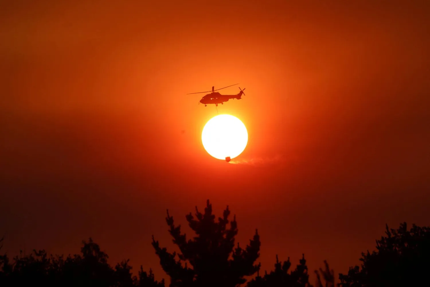
From Argentina to Australia to South Africa, record heat and raging wildfires are rampaging through the Southern Hemisphere at the start of 2026, with scientists predicting that even more extreme temperatures could lie ahead - and possibly another global annual high - after three of the hottest years on record.
In January, a record-setting heat dome enveloped Australia, sending temperatures near 50 degrees C (122 degrees F) while heat and catastrophic wildfires gripped parts of South America, setting remote parts of Argentina's Patagonia ablaze and killing 21 people in coastal towns in Chile. In addition, South Africa has been experiencing its worst wildfires in years.
The extremes are occurring even as the world remains under the cooling influence of a weak La Nina, a climate cycle marked by cooler waters in the central and eastern Pacific that began in December 2024. Despite this moderating factor, temperatures are reaching record highs in various locales.
"This means the effect of human-caused climate change is overwhelming natural variability," said climate scientist Theodore Keeping of Imperial College London and the international research collaboration World Weather Attribution, who specializes in research on wildfires and extreme heat.
"As we transition into a neutral or even El Nino phase, we'll expect the incidence of extreme heat events around the world to be further amplified," Keeping added.
El Nino typically has the opposite effect of La Nina, warming the central and eastern Pacific and boosting global temperatures.
This year is forecast to be about 1.46 degrees C (2.6 degrees F) above pre-industrial levels, which would make it the fourth consecutive year to be higher than 1.4 degrees C (2.5 degrees F) above pre-industrial levels, according to Adam Scaife, head of the long-range prediction at the United Kingdom's national weather and climate service.
The 2015 international climate treaty, known as the Paris Agreement, aimed to keep warming below 1.5 degrees C (2.7 degrees F) above pre-industrial levels.
"If a big El Nino were to develop quickly in 2026 then it's still possible 2026 could be a record," Scaife said. The World Meteorological Organization said last month that the past three years were the warmest on record.
FIRE RAGES FROM WOODS TO WATER
While most wildfires are caused by human activity, they are also a natural part of many ecosystems. Persistent heat, drought and extreme temperatures, however, are turning once-manageable fires into increasingly uncontrollable and destructive events.
Many ecosystems are not adapted to such hot, dry conditions, allowing fires to grow larger and more intense, often causing permanent damage, Keeping said.
The fires that burned through Argentina's Los Alerces National Park illustrate the shift, according to meteorologist Carolina Vera of the Center for Ocean and Atmospheric Research at the University of Buenos Aires.
The park, a UNESCO World Heritage site, is home to trees that have lived more than 3,000 years.
Local officials determined that a lightning strike caused the fire. The blaze initially was under control. But Vera said a heat wave and strong winds caused it to spread about 20 km (12 miles) in a single day, making it the worst wildfire there in two decades.
The region has been drought-stricken since 2008. Temperatures during the first two weeks of January were about 6 degrees C (11 degrees F) above normal.
"These fires used to burn themselves out and form part of the forest's natural dynamics," Vera said.
"This is an example of how climate change can alter a natural fire, because it appeared to be caused by lightning," Vera said.
There are no towns in that remote area.
Fires erupted in the southern part of neighboring Chile later in January and crossed into the greater Concepcion area, the country's third-largest metropolitan region, destroying hundreds of homes and killing 21 people in coastal communities.
Keeping said the blazes mirrored recent disasters in places such as Los Angeles, Athens and the Hawaiian island of Maui.
"Where there's been the greatest loss of life, it almost always comes down to evacuation being difficult or impossible," Keeping said. "That's particularly true in regions affected by strong downslope winds toward the coast."
WHIRLWINDS OF FIRE
About 80% of Punta de Parra, a small coastal town in southern Chile surrounded by hills and forests, was destroyed.
Punta de Parra residents said they had little time to evacuate. Doralisa Silva, 34, said she heard about a fire in a nearby community the night the blaze reached the town.
"Out of nowhere, the forest started burning and all the houses caught fire," Silva said. "The fire was on us in the blink of an eye. There was nothing we could do."
Silva said her family was among the last to try to flee because they had no vehicle. Silva said flames blocked their exit as embers rained down as she and her partner Hermes Barrientos fled with their 2-year-old daughter.
Barrientos said winds of nearly 70 km per hour (43.5 mph) whipped through the area, creating whirlwinds of fire that spread to the beach and trapped residents. The family and others eventually found refuge in a large dirt field at the center of town, and spent the night watching their community burn.
A FUTURE FILLED WITH FIRES
Record-breaking heat in southeastern Australia has also fueled the country's worst fires since the deadly 2019-2020 season, when 33 people were killed.
In addition, the 2025-2026 fire season has been the most severe in South Africa in a decade, according to officials, killing wildlife and hitting tourist destinations such as Mossel Bay and Franschhoek.
"The hot, dry and windy conditions that drive the most extreme wildfires are becoming more intense and more likely," Keeping said. "And it's happening all around the world."
The Southern Hemisphere has warmed by about 0.15 to 0.17 degrees C (0.27 to 0.30 degrees F) per decade since the 1970s, compared to 0.25 to 0.30 degrees C (0.45 to 0.54 degrees F) in the Northern Hemisphere - largely because its vast oceans absorb heat more slowly and because of Antarctic meltwater.
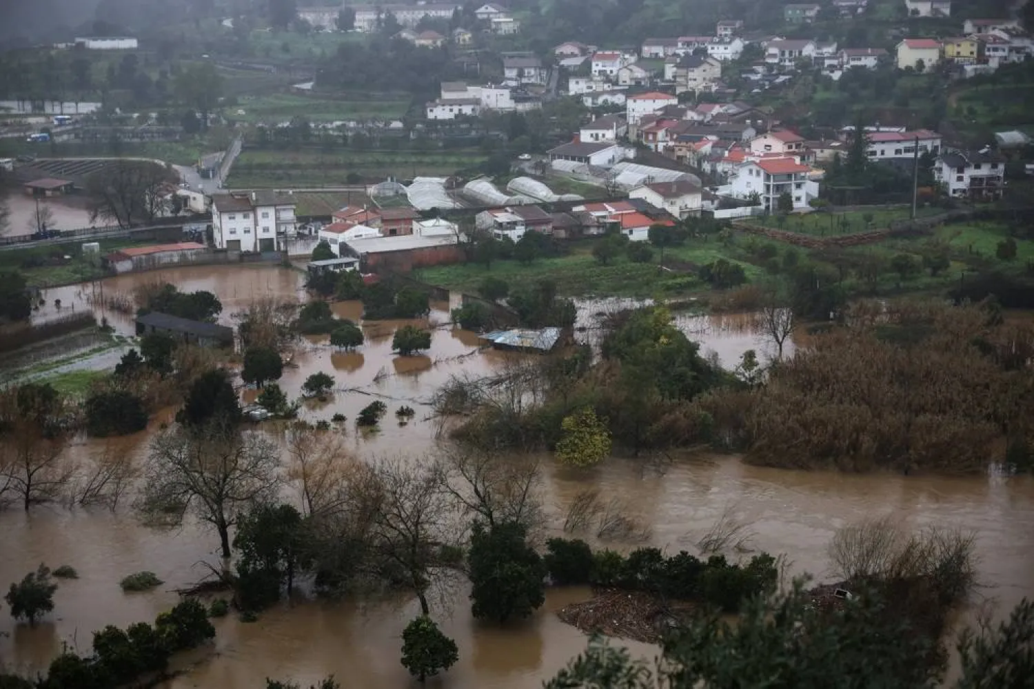
Still, southern land masses are now warming at similar rates to northern land masses, and contrasts between warming land and cold meltwater can intensify weather patterns, leading to prolonged heat waves, droughts or flooding.
Keeping said adaptation is critical, including authorities managing vegetation near cities and developing effective evacuation plans, and builders using fire-resistant materials. Wildfires are inflicting mounting economic damage. A 2026 report by insurance broker Aon estimated global insured wildfire losses at $42 billion in 2025, up from an average of $4 billion annually between 2000 and 2024. The Los Angeles fires last year were the costliest on record.
Swiss Re, the world's second-largest reinsurer, found that wildfires accounted for about 1% of global insured losses from natural disasters before 2015, but now represent 7%, with economic losses linked to fires rising by about $170 million a year since 1970.
"You actually cannot stop a lot of these really large intense wildfires. They're simply too big," Keeping said.
The most important way forward, Keeping said, is to "have a serious conversation about limiting future climate change to prevent this issue from worsening."