Beryl Bears Down on Texas, Where It Is Expected to Hit after Regaining Hurricane Strength

A drone view shows homes near the sea as tropical storm Beryl continues to move through the Gulf of Mexico, in Playa Bagdad, Mexico July 6, 2024. (Reuters)
TT

Beryl Bears Down on Texas, Where It Is Expected to Hit after Regaining Hurricane Strength

A drone view shows homes near the sea as tropical storm Beryl continues to move through the Gulf of Mexico, in Playa Bagdad, Mexico July 6, 2024. (Reuters)

Beryl was hurtling across the warm waters of the Gulf of Mexico on a collision course with Texas, forecast to pick up strength and regain hurricane status before nearing the coast Sunday and making landfall the following day with heavy rains, howling winds and dangerous storm surge.

A hurricane warning was declared for a large stretch of the coast from Baffin Bay, south of Corpus Christi, to Sargent, south of Houston, and storm surge warnings were also in effect. Other parts were under tropical storm warnings.

“We’re expecting the storm to make landfall somewhere on the Texas coast sometime Monday, if the current forecast is correct,” said Jack Beven, a senior hurricane specialist at the National Hurricane Center in Miami. “Should that happen, it’ll most likely be a Category 1 hurricane.”

As of Saturday night, Beryl was about 330 miles (535 kilometers) southeast of Corpus Christi and had top sustained winds of 60 mph (95 kph), according to the National Hurricane Center. It was moving northwest at 13 mph (20 kph).

The earliest storm to develop into a Category 5 hurricane in the Atlantic, Beryl caused at least 11 deaths as it passed through the Caribbean earlier in the week. It then battered Mexico as a Category 2 hurricane, toppling trees but causing no injuries or deaths before weakening to a tropical storm as it moved across the Yucatan Peninsula.

Texas officials warned people along the entire coastline to prepare for possible flooding, heavy rain and wind.

Lt. Gov. Dan Patrick, who is acting governor while Gov. Greg Abbott is traveling in Taiwan, issued a preemptive disaster declaration for 121 counties.

“Beryl is a determined storm, and incoming winds and potential flooding will pose a serious threat to Texans who are in Beryl’s path at landfall and as it makes its way across the state for the following 24 hours,” Patrick said Saturday in a statement.

Some coastal cities called for voluntary evacuations in low-lying areas that are prone to flooding, banned beach camping and urged tourists traveling on the Fourth of July holiday weekend to move recreational vehicles from coastal parks.

Mitch Thames, a spokesman for Matagorda County, said officials issued a voluntary evacuation request for the coastal areas of the county about 100 miles (160 kilometers) southwest of Houston.

“Our No. 1 goal is the health and safety of all our visitors and of course our residents. I’m not so much worried about our residents. Those folks that live down there, they’re used to this, they get it,” Thames said.

In Corpus Christi, officials asked visitors to cut their trips short and return home early if possible. Residents were advised to secure homes by boarding up windows if necessary and using sandbags to guard against possible flooding.

Traffic has been nonstop for the past three days at an Ace Hardware in the city as customers buy tarps, rope, duct tape, sandbags and generators, employee Elizabeth Landry said Saturday.

“They’re just worried about the wind, the rain,” she said. “They’re wanting to prepare just in case.”

Ben Koutsoumbaris, general manager of Island Market on Corpus Christi’s Padre Island, said there has been “definitely a lot of buzz about the incoming storm,” with customers stocking up on food and drinks.

In Refugio County, north of Corpus Christi, officials issued a mandatory evacuation order for its 6,700 residents.

Before hitting Mexico, Beryl wrought destruction in Jamaica, St. Vincent and the Grenadines, and Barbados. Three people were reported dead in Grenada, three in St. Vincent and the Grenadines, three in Venezuela and two in Jamaica.

KAUST Unveils Landmark Coral Facility on Red Sea, Advancing Saudi Scientific Expertise and Marine Conservation

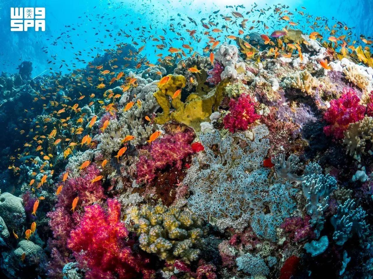
KCRI is designed to restore the Red Sea reefscape and offer a framework that coral restoration programs worldwide can adopt. (SPA)
TT

KAUST Unveils Landmark Coral Facility on Red Sea, Advancing Saudi Scientific Expertise and Marine Conservation

KCRI is designed to restore the Red Sea reefscape and offer a framework that coral restoration programs worldwide can adopt. (SPA)

The King Abdullah University of Science and Technology (KAUST) launched the KAUST Coral Restoration Initiative’s large-scale coral facility, restoring and advancing one of Saudi Arabia’s most precious natural assets, reported the Saudi Press Agency on Wednesday.

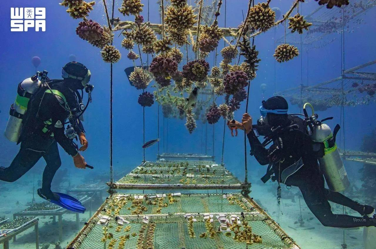
On Saudi Arabia’s Red Sea coast, the KAUST Coral Restoration Initiative (KCRI) land-based nursery and research campus is now growing corals at scale. It is designed to produce up to 360,000 corals a year, to outplant more than two million corals across 100 hectares of reef at Shushah Island by 2030, and to establish a resilient reef ecosystem by 2040.

This opening of the world’s largest coral restoration facility, announced at COP31 in Antalya, arrives at a moment of acute urgency for the world’s reefs. The fourth global coral bleaching event, confirmed by NOAA as the most severe in recorded history, affected more than 84% of the world’s reef area between 2023 and 2025.

Coral reefs support around a quarter of all marine species, protect coastlines from storms and sustain the livelihoods of more than 500 million people. (SPA)

The Red Sea is the right place to start. Its corals live in some of the warmest, saltiest waters on Earth, and they hold lessons about resilience that reefs everywhere will need. KCRI combines the Red Sea’s unique corals with KAUST’s world-class marine science to learn how corals can be grown at scale and conditioned to withstand warmer water before they return to the reef.

The initiative also draws on the expertise of the Coral Research and Development Accelerator Platform (CORDAP), which works internationally to accelerate scientific and technological solutions for coral reef conservation and restoration.

KCRI brings four components together in a single restoration system, including a large-scale land-based coral nursery, sea-based nurseries, more than 50 research programs spanning coral probiotics, heat-resilient corals, robotics and AI-driven modelling and eCoral, an AI-driven digital twin of the reefscape that guides where and how every coral is planted and monitored.

Saudi scientists, divers and aquarists are playing an important role in KCRI’s restoration efforts, developing specialist expertise in coral cultivation, marine science and reef restoration. (SPA)

Saudi scientists, divers and aquarists are playing an important role in KCRI’s restoration efforts, developing specialist expertise in coral cultivation, marine science and reef restoration. Beyond its restoration activities, KCRI represents a long-term investment in Saudi Arabia’s marine science capabilities.

Coral reefs support around a quarter of all marine species, protect coastlines from storms and sustain the livelihoods of more than 500 million people. KCRI is designed to restore the Red Sea reefscape and offer a framework that coral restoration programs worldwide can adopt.

KAUST is also working with international partners on how coral diversity can be safeguarded for future generations.


Portugal Closes All Schools and Non-Essential Services Ahead of a Major Atlantic Storm

Heavy machinery clears the debris from a landslide along the Marocos road in Machico municipality, on the Portuguese island of Madeira, due to severe weather caused by the passage of Storm Charles, 11 November 2026. (EPA)
TT

Portugal Closes All Schools and Non-Essential Services Ahead of a Major Atlantic Storm

Heavy machinery clears the debris from a landslide along the Marocos road in Machico municipality, on the Portuguese island of Madeira, due to severe weather caused by the passage of Storm Charles, 11 November 2026. (EPA)

Portugal closed all schools and shuttered non-essential public services on Wednesday as a major Atlantic storm headed for the country's mainland.

Streets remained largely deserted ahead of the arrival of Storm Charles after the government told people to stay at home as heavy rain and rough seas were expected to batter the Portuguese coast, with wind gusts of up to 140 kph (85 mph).

It was the first time in living memory that Portugal’s roughly 8,000 schools had canceled classes nationwide over a storm forecast.

Buses without passengers drove through the country's capital, Lisbon, where some streets flooded due to clogged drains. A national supermarket chain closed its stores, while an international technology conference in Lisbon attended by around 70,000 people called off the day's events.

In January, the country's center-right government faced harsh criticism for its weak response when Storm Kristin hit central Portugal, felling thousands of trees and causing widespread property damage that is still being repaired.

The brunt of Storm Charles was expected to hit the Atlantic coast on Wednesday afternoon and evening, coming from the southwest after it had struck the Portuguese island of Madeira on Tuesday with 130 kph (81 mph) winds.


Once the World's Fastest, Ocean Liner Will Become Largest Artificial Reef

The S.S. United States crossed the Atlantic more than 800 times. (Getty Images)
TT

Once the World's Fastest, Ocean Liner Will Become Largest Artificial Reef

The S.S. United States crossed the Atlantic more than 800 times. (Getty Images)

An ocean liner that is longer than the Titanic and was once the fastest on the seas is headed to a final home on the floor of the Gulf of Mexico as the world's largest artificial reef.

The S.S. United States is scheduled to be sunk Wednesday off the coast of the Florida Panhandle, fulfilling a long-planned $13.5 million project aimed at attracting more divers and fishing enthusiasts to the area while creating a home for tuna, marlin and swordfish.

The project will keep what had been a technological marvel when it made its maiden voyage in 1952 from becoming scrap metal.

The S.S. United States crossed the Atlantic more than 800 times, carrying old Hollywood stars like Grace Kelly and Elizabeth Taylor. Other passengers have included President John F. Kennedy and Britain’s former King Edward VIII. In 1968, a young Bill Clinton took it when he went to Oxford University, decades before he was elected president.

In preparation for the sinking, organizers removed the 65-foot smokestacks and plan to have them anchor a new museum that celebrates the ship. Once aboard, passengers were treated to dinners that included caviar, roast duckling, smoked ox tongue and Calf's Head en Tortue.

“It was our goal to make sure that she wasn’t lost forever,” said David Lawrence, a member of the board for the S.S. United States Conservancy, which is dedicated to preserving the ship.

The ship will be sunk without using explosives

Federal environmental and explosives rules prevent Okaloosa County, Florida, and its contractor from using explosives to scuttle the ship, said Nick Tomecek, the county's spokesperson. Concerns about inclement weather prompted officials to move up the sinking by a day.

The S.S. United States has pipes that pulled seawater into tanks as part of the system that cooled its boilers, he said, and those tanks have been removed so that once the valves are opened, water will flood the hull. Workers also have cut 10-foot by 10-foot holes in the decks, and more than 400 portholes have been removed.

The ship is to sink in about 180 feet (55 meters) of water, with its top deck about 60 feet (18 meters) below the surface — shallow enough that inexperienced divers can visit. It will settle on the floor of the waters about 25 miles (40 kilometers) southwest of Destin, between Panama City and Pensacola.

Larger than the Titanic, the ship's first voyage set a speed record

More than 3,000 workers helped build the S.S. United States in 1950 and 1951 in Virginia. An Associated Press reporter and President Harry Truman's daughter, Margaret, were among 1,700 passengers for the first voyage.

The ship's average speed for that trip was almost 41 miles (66 kilometers) per hour, besting a record set by Britain's R.M.S. Queen Mary in 1938 by 4.5 miles (7.2 kilometers) per hour, according to the AP's dispatch.

The S.S. United States set the record even though its journey ended in the face of a full gale that reached 69 miles (111 kilometers) per hour — “so strong it blew a ping pong table off the deck,” AP reported.

At 990 feet (302 meters), the ship is 108 feet (33 meters) longer than the ill-fated Titanic, which hit an iceberg and sank on its first voyage across the Atlantic.

“She really embodies and expresses this country’s best,” said Susan Gibbs, the granddaughter of the ship's designer. “She represents pride and resilience and strength and beauty.”

The ship's resting place has many artificial reefs

About 500 artificial reefs are located in the waters near where the S.S. United States will rest, Tomecek said.

Previously, the largest artificial reef came from the 2006 scuttling of an aircraft carrier, the USS Oriskany in the Gulf off of Pensacola — near enough to the S.S. United States site that an experienced diver could visit both in the same day, Tomecek said. The Oriskany, launched in 1950, was 911 feet (278 meters) in length.

“We're trying to be the best diving destination in the world,” Tomecek said.

The ship was decommissioned in 1969. Attempts by a hotel magnate and Norwegian Cruise Lines to use the ship never floated, and from 1996 until recently, it sat along a dock in Philadelphia.

“I’m just so happy that we are able to save parts of her,” Gibbs said.