

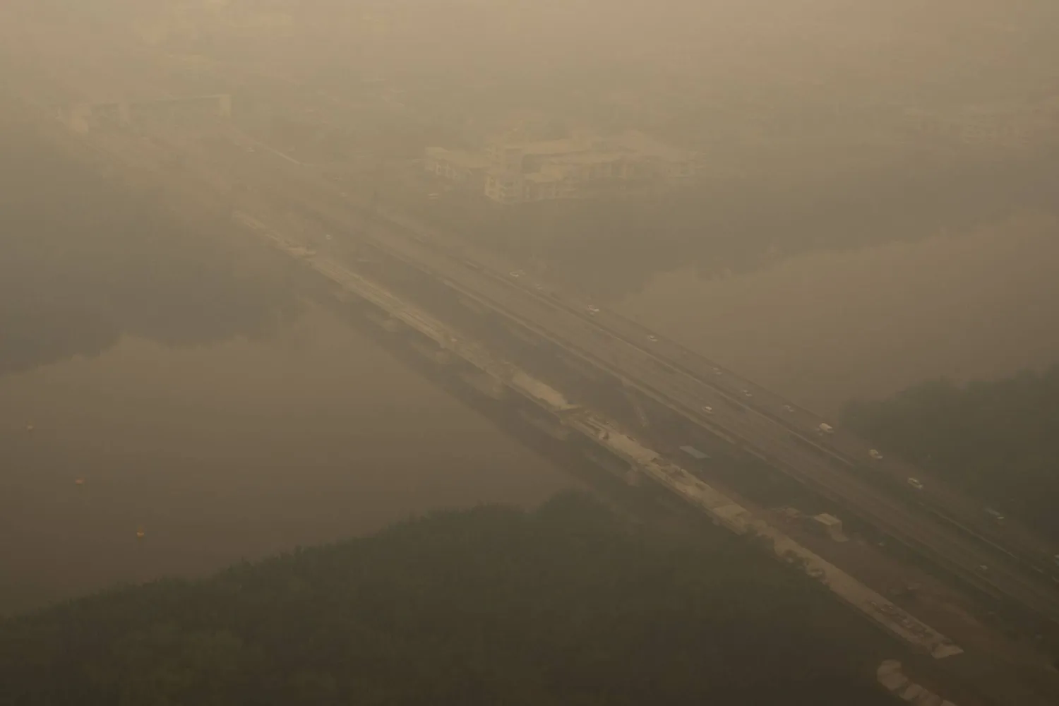

Indonesian Wildfire Emissions Surge to World’s Highest, Data Shows

This aerial photo taken from a commercial aircraft shows haze from Indonesian forest fires blanketing a bridge in Kuching, the capital city of Malaysia's Sarawak state on the island of Borneo on September 5, 2026. (AFP)
TT

Indonesian Wildfire Emissions Surge to World’s Highest, Data Shows

This aerial photo taken from a commercial aircraft shows haze from Indonesian forest fires blanketing a bridge in Kuching, the capital city of Malaysia's Sarawak state on the island of Borneo on September 5, 2026. (AFP)

Indonesia is facing a surge in emissions from wildfires burning through parched stretches of forest and peatland on the islands of Borneo and Sumatra, with carbon dioxide readings currently the highest in the world, data showed on Wednesday.

Fire emissions from Indonesia from September 1 to September 7 reached 19.7 million metric tons, overtaking Russia this week and making up more than a third of the global total, according to Fire Emissions Watch, a portal developed by the European Union's Copernicus climate monitoring service.

Indonesia is one of the world's most fire-prone countries, but as "super-El Nino" weather conditions drive up temperatures and cause punishing droughts, the country is battling what authorities say is its most intense wildfire season in 11 years.

"We do expect to see some fires across the region at this time of year, but with El Nino, it clearly ‌just gives a ‌big enhancement to them," said Mark Parrington, senior scientist at the Copernicus Atmosphere Monitoring Service ‌in ⁠Bonn.

"It's much drier, ⁠it's hotter, and when there's ignition, these fires burn in a far more extreme way."

From September 1 to September 7, fire emission intensity exceeded 1,500 kg/sq km, more than 10 times the Russian level, with the highest concentrations in Kalimantan in Indonesia's part of Borneo and eastern parts of Sumatra, Copernicus data showed on Wednesday.

Emissions were 273% higher than the seasonal average, though still lower than the 21.7 million tons emitted in the same week of 2015, when Indonesia was battling similarly intense El Nino conditions.

Among the hardest hit areas has been the city of Pontianak in West Kalimantan, where the air quality index was ⁠394 on Wednesday, according to Swiss air quality monitoring firm IQAir. A reading of 300 ‌is considered hazardous.

Indonesia's environment ministry told Reuters in a statement that it ‌viewed the hazardous air quality readings in Kalimantan and elsewhere "with concern".

It said it was monitoring Copernicus's data, but added it "does not ‌directly reflect air quality conditions in a specific area", and other factors needed to be taken into account.

'BELOW THE ‌DETECTION LIMIT'

From January to July this year, fires burned around 202,000 hectares (780 square miles) of Indonesian land, about a third the amount over the same period in 2015, said Nisa Novita of the environmental group YKAN, which helps communities tackle fires.

"However, August data are estimated to show a significant increase of around 600,000 hectares, particularly in Kalimantan, Sumatra and South Papua," she said.

Indonesia lost a total ‌of 2.6 million hectares to fire in the whole of 2015, an area bigger than Wales.

The number of recorded hotspots from August 1 to September 8 reached ⁠13,443, compared to 9,454 over ⁠the same period of 2015, according to Indonesian forest ministry monitoring platform Sipongi, based on data from NASA's Terra and Aqua satellites.

A record monthly high for hotspots was recorded in October 2015, Sipongi data showed.

Fire Emissions Watch uses satellite observations to estimate concentrations of particulate matter, volatile organic compounds, greenhouse gases and other fire-fuelled pollutants, but Parrington said it could actually be underestimating the extent of the problem.

"One of the aspects with peat fires is if they're burning at low temperatures or underground, they'd be below the detection limit of the sensors, which means we're not actually seeing them," he said.

Studies have shown that fires in Indonesia in 2015 produced more emissions per day than the whole of the EU, and caused more than 100,000 excess deaths throughout Indonesia, Malaysia and Singapore.

"We have to remember that this is still the beginning of the season, and we expect the fires to continue and the emissions to keep increasing, potentially through to the end of October, which is what we saw in 2015," said Parrington.

"In two months we'll know how extreme this year has been, but the early indications are that it is at pace, if not slightly above those previous El Nino years."



Italy's Catania Airport Reopens as Etna Threat Downgraded

Visitors climb Mount Etna as smoke rises from its volcano in Catania, on the Mediterranean island of Sicily, on September 28, 2026. (Photo by Roman PILIPEY / AFP)
TT

Italy's Catania Airport Reopens as Etna Threat Downgraded

Visitors climb Mount Etna as smoke rises from its volcano in Catania, on the Mediterranean island of Sicily, on September 28, 2026. (Photo by Roman PILIPEY / AFP)

Italy's Catania airport resumed flights on Tuesday after briefly halting operations due to renewed volcanic activity from nearby Mount Etna and adverse weather conditions, in the latest stop-and-go disruption to air traffic.

According to Reuters, Operator SAC said ⁠flights to and ⁠from the airport had resumed with immediate effect after the volcanic alert level was lowered from red to ⁠orange.

The hub had previously suspended operations until 1300 GMT on Tuesday, only hours after ending a three-day shutdown on Monday evening.

The Sicilian airport, Italy's fifth-busiest by passenger traffic, is often disrupted by volcanic ⁠ash ⁠interference from Mount Etna, Europe's highest and most active volcano.

The latest shutdown affected thousands of passengers and placed significant pressure on other Sicilian airports, as airlines diverted flights away from Catania.


Scientists: Rising Seas Threaten Spread of Marine Invaders

An aerial view of fishermen returning from sea at the traditional fishing port in Banda Aceh, Indonesia, 29 September 2026. EPA/HOTLI SIMANJUNTAK
TT

Scientists: Rising Seas Threaten Spread of Marine Invaders

An aerial view of fishermen returning from sea at the traditional fishing port in Banda Aceh, Indonesia, 29 September 2026. EPA/HOTLI SIMANJUNTAK

Sea-level rise driven by climate change could help invasive marine species spread into newly flooded coastal areas, threatening biodiversity and some economic activities, researchers warned in a study published Monday.

The findings in Nature Ecology & Evolution highlight the links between the climate and biodiversity crises, with global warming altering ecosystems and creating new opportunities for non-native species to thrive.

That could "potentially expose ecosystems and human activities that have not previously been affected by these species," said study co-author Xuan Liu of Beijing Normal University.

The researchers modelled the potential future spread of 122 established non-native marine animals, including fish, crustaceans, molluscs and sea stars, under different climate and sea-level scenarios.

Climate change causes sea levels to rise through thermal expansion -- ocean water increases in volume as it warms -- and the melting of glaciers and ice sheets.

Global sea levels are projected to rise by about 20 centimeters (eight inches) by 2050 and 56 cm by 2100 under a scenario of moderate growth in greenhouse gas emissions.

That would see around 360,000 square kilometers (139,000 square miles) of coastal land flooded by mid-century, rising to 550,000 square kilometers by the end of the century.

More than two-thirds of the newly flooded coastal land -- roughly 290,000 to 470,000 square kilometers -- could become suitable for the marine non-native animals studied, particularly around estuaries at mid-latitudes, AFP quoted the authors as saying.

The risk is concentrated in regions including the eastern United States, Gulf of Mexico, North Sea, Gulf of Guinea, Arabian Gulf, northern Bay of Bengal, southeastern China and northern Australia.

Several species examined are already established in Europe, including the Pacific oyster, Atlantic blue crab and the veined rapa whelk, a predatory sea snail.

"Estuaries are particularly at risk because they are directly connected to the ocean and are also major hubs of human activity," Liu said.

Such areas could provide stepping stones for marine invaders moving further inland as the sea advances, the study said.

The findings come as governments prepare for two UN-backed international summits on the twin biodiversity and climate crises: COP17 in October and COP31 in November.

A global assessment by the UN's expert scientific panel on biodiversity, IPBES, estimated that economic costs from biological invasions exceeded $423 billion in 2019.


Cape Town Divided Over Plan to Remove its Monkeys

The baboons’ presence has affected house prices on the Cape Peninsula, as they raid bins and kitchens and poo on properties. (Nic Bothma/Reuters)
TT

Cape Town Divided Over Plan to Remove its Monkeys

The baboons’ presence has affected house prices on the Cape Peninsula, as they raid bins and kitchens and poo on properties. (Nic Bothma/Reuters)

At the edge of Da Gama Park, where suburb meets the mountain, Cape Town’s baboons have caused conflict, with a furious debate raging over whether the monkeys can coexist with humans or whether they should be kept away.

On Monday, Cape Town’s city council has said it will “imminently” round up two baboon troops coming into repeated conflict with residents. The animals will be sterilized and permanently moved to a newly constructed sanctuary.

The plan has been fiercely criticized by animal rights activists, who say the monkeys should remain roaming freely, and that less destructive options have not been properly considered, according to The Guardian.

Cape Town’s baboon problem has been brewing since the 2000s, after the city stopped culling troops in the late 1990s after pressure from the public. But in the past two years it has reached boiling point.

A 2025 census found that the population had grown by a third since 2000, from 360 baboons to 493, now living in 12 managed troops.

As a result of the population boom, troops of chacma baboons on the city’s peninsula regularly rip off roof sheeting, sneak into unlocked cars and raid food pantries.

Some monkeys are now staying up late into the night to break into homes in Simon’s Town and nab snacks from convenience stores. Residents can no longer barbecue or host garden parties for fear of the marauding baboons.

“It’s depreciated property values because it’s hard to sell a house when it’s covered in baboon feces and paw prints, and you know they’re coming every day,” said Justin O’Riain, a behavioral ecologist at the University of Cape Town who has long studied the local baboons.

Cape Town’s geography is partially to blame. Much of the problem is confined to the Cape Peninsula, a narrow sliver of land stretching from the city center to Cape Point.

Here, baboons are boxed in between the steep, protected area of Table Mountain national park and the sprawling urban development that stretches to the Atlantic Ocean.

“The underlying issue is that baboons will seek low-lying land. That is their natural drive – it’s better access to water and more productive vegetation,” said Joselyn Mormile, who leads the Cape Baboon Partnership (CBP), a nonprofit organization that works with the city and local conservation authorities to manage the baboons.

“But throughout the peninsula, we’ve developed most of those places. It’s a constant battle between the two,” she noted.