Damaged and Drained, Indonesia's Peatlands Go Up in Smoke

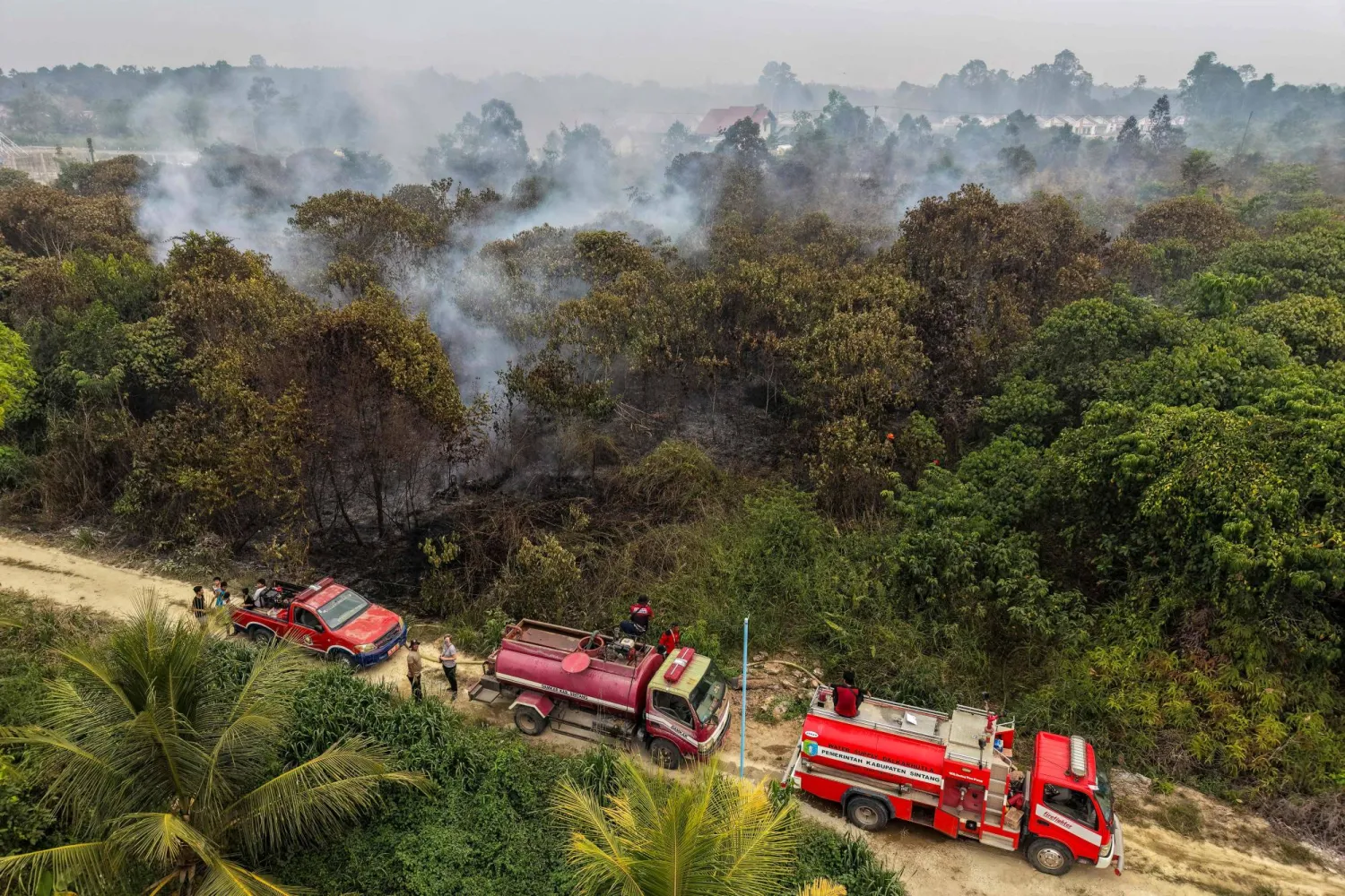
(FILES) This aerial picture shows fire fighters battling peatland fires in Sintang, West Kalimantan on September 5, 2026. (Photo by BAY ISMOYO / AFP)
TT

Damaged and Drained, Indonesia's Peatlands Go Up in Smoke

(FILES) This aerial picture shows fire fighters battling peatland fires in Sintang, West Kalimantan on September 5, 2026. (Photo by BAY ISMOYO / AFP)

For weeks on end, parts of Indonesian Borneo have resembled an Armageddon landscape with masked residents immersed in a putrid, red-brown haze as wildfires devour peatlands near homes and farms.

Burning slowly, mostly under the surface and sometimes for months on end, peatland fires are responsible for much of the dry season haze that this year has tainted air as far afield as Malaysia, Singapore and the Philippines.

- What are peatlands? –

Peatlands are composed of organic material that does not completely decompose in water-logged conditions and has settled over thousands of years into a layered soil-like substance.

Healthy peatlands are home to diverse plants and trees like nutmeg and durian, and animals that can include endangered orangutans, clouded leopards, Sumatran tigers, sun bears and tapirs.

They are porous and absorbent, making them critical for flood containment.

While they cover only about three percent of global land, peatlands store about a third of the world's soil carbon -- double that trapped by forests.

Indonesia has the world's biggest share of tropical peatland, about a third of the global total.

- Why are they burning? –

Of Indonesia's estimated 24.2 million hectares (93,400 square miles) of peatland, 16.4 million hectares have been degraded and are vulnerable to fire, according to the Pantau Gambut NGO.

The culprit is mainly industrial-scale plantations for timber, pulp and paper, rice paddies and palm oil, of which Indonesia is the world's biggest producer by far.

To cultivate peatlands, they are drained with canal networks that in Indonesia span about 285,000 kilometers (177,000 miles), according to Pantau Gambut research -- seven times the circumference of Earth.

The water runs into rivers or the sea, leaving the dried-out peatlands vulnerable to burning, especially in strong El Nino years that can bring severe drought to Indonesia.

Peatland fires are often imperceptible but for the foul smoke they emit and the heat they generate underfoot, AFP reported.

The many layers of thick carbon can keep smoldering in "zombie fires" for weeks, and are hard to put out.

- What are the impacts? -

While less than a third of wildfires in Indonesia are on peatlands, they produce most of the haze, according to Greenpeace research.

This toxic smog contains harmful elements including formaldehyde, hydrogen cyanide and ammonia, as well as PM2.5 particles small enough to penetrate the lungs or bloodstream.

The World Health Organization has linked PM2.5 exposure to increased illness and death.

Indonesia and Malaysia have shut hundreds of schools over haze, and more than 170,000 people in Indonesia required treatment for acute respiratory infections in August and September, according to the health ministry.

Many more fell ill in Malaysia and Singapore.

Peatland fires also ravage the habitats of animals, further imperiling already endangered species such as orangutans and Sumatran rhinos.

- What about greenhouse gases? -

By October 6, Indonesian wildfires had emitted 140.5 megatons of planet-warming carbon, around 13 percent of the global total this year, according to the Copernicus Atmosphere Monitoring Service.

That was the highest figure for Indonesia fire emissions since 2019, another strong El Nino year.

Indonesia emits significant greenhouse gases from its coal-powered electricity grid, and is seeking to reduce its emissions in part by relying on forests, peatlands and other land ecosystems to absorb more than they emit.

- What is being done? -

Activists and experts say concession licenses for extractive activities on peatlands must be revoked, and peatlands should be rewetted and planted with native species.

Canals should be blocked, they say.

Indonesia has a moratorium in place on new permits to clear 66 million hectares of land designated as primary forest and peatland.

In a statement last year, the government said it had rewetted 4.16 million hectares of peatland, built 45,000 canal barriers and replanted various native species.

But there are doubts about some of that work.

"Today, some of the peat hydrological units that have received major restoration efforts... have experienced fires and have some of the highest hotspot counts," Greenpeace forest campaigner Belgis Habiba told AFP.

Last month, the government announced the creation of a new National Peatland and Mangrove Management agency to replace a body whose mandate expired in 2024.

The agency's remit and resources are still being worked out, but there are concerns its name mentions neither restoration nor protection.

"Does managing in this context serve as a pretext for the state to grant new concessions on peatlands?" asked Belgis.

The forestry ministry did not reply to AFP's request for input.


KAUST Unveils Landmark Coral Facility on Red Sea, Advancing Saudi Scientific Expertise and Marine Conservation

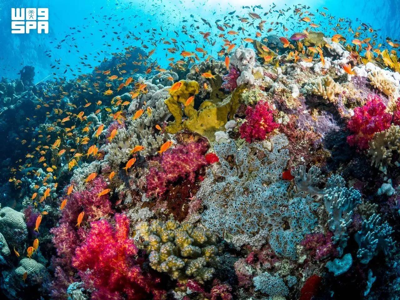
KCRI is designed to restore the Red Sea reefscape and offer a framework that coral restoration programs worldwide can adopt. (SPA)
TT

KAUST Unveils Landmark Coral Facility on Red Sea, Advancing Saudi Scientific Expertise and Marine Conservation

KCRI is designed to restore the Red Sea reefscape and offer a framework that coral restoration programs worldwide can adopt. (SPA)

The King Abdullah University of Science and Technology (KAUST) launched the KAUST Coral Restoration Initiative’s large-scale coral facility, restoring and advancing one of Saudi Arabia’s most precious natural assets, reported the Saudi Press Agency on Wednesday.

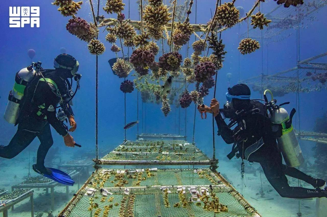
On Saudi Arabia’s Red Sea coast, the KAUST Coral Restoration Initiative (KCRI) land-based nursery and research campus is now growing corals at scale. It is designed to produce up to 360,000 corals a year, to outplant more than two million corals across 100 hectares of reef at Shushah Island by 2030, and to establish a resilient reef ecosystem by 2040.

This opening of the world’s largest coral restoration facility, announced at COP31 in Antalya, arrives at a moment of acute urgency for the world’s reefs. The fourth global coral bleaching event, confirmed by NOAA as the most severe in recorded history, affected more than 84% of the world’s reef area between 2023 and 2025.

Coral reefs support around a quarter of all marine species, protect coastlines from storms and sustain the livelihoods of more than 500 million people. (SPA)

The Red Sea is the right place to start. Its corals live in some of the warmest, saltiest waters on Earth, and they hold lessons about resilience that reefs everywhere will need. KCRI combines the Red Sea’s unique corals with KAUST’s world-class marine science to learn how corals can be grown at scale and conditioned to withstand warmer water before they return to the reef.

The initiative also draws on the expertise of the Coral Research and Development Accelerator Platform (CORDAP), which works internationally to accelerate scientific and technological solutions for coral reef conservation and restoration.

KCRI brings four components together in a single restoration system, including a large-scale land-based coral nursery, sea-based nurseries, more than 50 research programs spanning coral probiotics, heat-resilient corals, robotics and AI-driven modelling and eCoral, an AI-driven digital twin of the reefscape that guides where and how every coral is planted and monitored.

Saudi scientists, divers and aquarists are playing an important role in KCRI’s restoration efforts, developing specialist expertise in coral cultivation, marine science and reef restoration. (SPA)

Saudi scientists, divers and aquarists are playing an important role in KCRI’s restoration efforts, developing specialist expertise in coral cultivation, marine science and reef restoration. Beyond its restoration activities, KCRI represents a long-term investment in Saudi Arabia’s marine science capabilities.

Coral reefs support around a quarter of all marine species, protect coastlines from storms and sustain the livelihoods of more than 500 million people. KCRI is designed to restore the Red Sea reefscape and offer a framework that coral restoration programs worldwide can adopt.

KAUST is also working with international partners on how coral diversity can be safeguarded for future generations.


Portugal Closes All Schools and Non-Essential Services Ahead of a Major Atlantic Storm

Heavy machinery clears the debris from a landslide along the Marocos road in Machico municipality, on the Portuguese island of Madeira, due to severe weather caused by the passage of Storm Charles, 11 November 2026. (EPA)
TT

Portugal Closes All Schools and Non-Essential Services Ahead of a Major Atlantic Storm

Heavy machinery clears the debris from a landslide along the Marocos road in Machico municipality, on the Portuguese island of Madeira, due to severe weather caused by the passage of Storm Charles, 11 November 2026. (EPA)

Portugal closed all schools and shuttered non-essential public services on Wednesday as a major Atlantic storm headed for the country's mainland.

Streets remained largely deserted ahead of the arrival of Storm Charles after the government told people to stay at home as heavy rain and rough seas were expected to batter the Portuguese coast, with wind gusts of up to 140 kph (85 mph).

It was the first time in living memory that Portugal’s roughly 8,000 schools had canceled classes nationwide over a storm forecast.

Buses without passengers drove through the country's capital, Lisbon, where some streets flooded due to clogged drains. A national supermarket chain closed its stores, while an international technology conference in Lisbon attended by around 70,000 people called off the day's events.

In January, the country's center-right government faced harsh criticism for its weak response when Storm Kristin hit central Portugal, felling thousands of trees and causing widespread property damage that is still being repaired.

The brunt of Storm Charles was expected to hit the Atlantic coast on Wednesday afternoon and evening, coming from the southwest after it had struck the Portuguese island of Madeira on Tuesday with 130 kph (81 mph) winds.


Once the World's Fastest, Ocean Liner Will Become Largest Artificial Reef

The S.S. United States crossed the Atlantic more than 800 times. (Getty Images)
TT

Once the World's Fastest, Ocean Liner Will Become Largest Artificial Reef

The S.S. United States crossed the Atlantic more than 800 times. (Getty Images)

An ocean liner that is longer than the Titanic and was once the fastest on the seas is headed to a final home on the floor of the Gulf of Mexico as the world's largest artificial reef.

The S.S. United States is scheduled to be sunk Wednesday off the coast of the Florida Panhandle, fulfilling a long-planned $13.5 million project aimed at attracting more divers and fishing enthusiasts to the area while creating a home for tuna, marlin and swordfish.

The project will keep what had been a technological marvel when it made its maiden voyage in 1952 from becoming scrap metal.

The S.S. United States crossed the Atlantic more than 800 times, carrying old Hollywood stars like Grace Kelly and Elizabeth Taylor. Other passengers have included President John F. Kennedy and Britain’s former King Edward VIII. In 1968, a young Bill Clinton took it when he went to Oxford University, decades before he was elected president.

In preparation for the sinking, organizers removed the 65-foot smokestacks and plan to have them anchor a new museum that celebrates the ship. Once aboard, passengers were treated to dinners that included caviar, roast duckling, smoked ox tongue and Calf's Head en Tortue.

“It was our goal to make sure that she wasn’t lost forever,” said David Lawrence, a member of the board for the S.S. United States Conservancy, which is dedicated to preserving the ship.

The ship will be sunk without using explosives

Federal environmental and explosives rules prevent Okaloosa County, Florida, and its contractor from using explosives to scuttle the ship, said Nick Tomecek, the county's spokesperson. Concerns about inclement weather prompted officials to move up the sinking by a day.

The S.S. United States has pipes that pulled seawater into tanks as part of the system that cooled its boilers, he said, and those tanks have been removed so that once the valves are opened, water will flood the hull. Workers also have cut 10-foot by 10-foot holes in the decks, and more than 400 portholes have been removed.

The ship is to sink in about 180 feet (55 meters) of water, with its top deck about 60 feet (18 meters) below the surface — shallow enough that inexperienced divers can visit. It will settle on the floor of the waters about 25 miles (40 kilometers) southwest of Destin, between Panama City and Pensacola.

Larger than the Titanic, the ship's first voyage set a speed record

More than 3,000 workers helped build the S.S. United States in 1950 and 1951 in Virginia. An Associated Press reporter and President Harry Truman's daughter, Margaret, were among 1,700 passengers for the first voyage.

The ship's average speed for that trip was almost 41 miles (66 kilometers) per hour, besting a record set by Britain's R.M.S. Queen Mary in 1938 by 4.5 miles (7.2 kilometers) per hour, according to the AP's dispatch.

The S.S. United States set the record even though its journey ended in the face of a full gale that reached 69 miles (111 kilometers) per hour — “so strong it blew a ping pong table off the deck,” AP reported.

At 990 feet (302 meters), the ship is 108 feet (33 meters) longer than the ill-fated Titanic, which hit an iceberg and sank on its first voyage across the Atlantic.

“She really embodies and expresses this country’s best,” said Susan Gibbs, the granddaughter of the ship's designer. “She represents pride and resilience and strength and beauty.”

The ship's resting place has many artificial reefs

About 500 artificial reefs are located in the waters near where the S.S. United States will rest, Tomecek said.

Previously, the largest artificial reef came from the 2006 scuttling of an aircraft carrier, the USS Oriskany in the Gulf off of Pensacola — near enough to the S.S. United States site that an experienced diver could visit both in the same day, Tomecek said. The Oriskany, launched in 1950, was 911 feet (278 meters) in length.

“We're trying to be the best diving destination in the world,” Tomecek said.

The ship was decommissioned in 1969. Attempts by a hotel magnate and Norwegian Cruise Lines to use the ship never floated, and from 1996 until recently, it sat along a dock in Philadelphia.

“I’m just so happy that we are able to save parts of her,” Gibbs said.